Storms are moving out, temperatures are set to soar in Maryland

Early strong storms have moved out of Maryland and off the east coast. Temperatures are quickly cooling through the 60s and into the 50s this evening. A breeze is making it feel even cooler outside this evening. You'll want a light jacket for outdoor evening plans.
Drier weather returns to Maryland
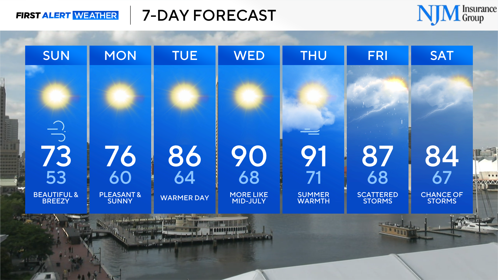
Sunday begins with cool temperatures. Plan on temperatures bottoming-out in the low to mid-50s across greater Baltimore and the eastern shore before 8 a.m. A few rural spots could fall into the upper 40s, especially northwest of Baltimore. Sunshine will be plentiful Sunday. Temperatures warm back into the mid and upper 70s Sunday afternoon, with a breeze.
The First Alert Forecast is dry to end the weekend.
Northern Lights may be viewable in Maryland
A severe (G4) geomagnetic storms is expected to produce a vast display of aurora borealis across portions of North America and Europe. The northern lights could be seen across Maryland Sunday night, into Monday morning. It will be most easily seen by taking long-exposure photos. However, it's possible that the lights could be seen by the naked eye - especially away from city lights.
Much warmer weather returns next week
A warming trend begins as we start the new workweek. By the middle of the week, temperatures are forecast to peak in the mid-80s. Temperatures continue to warm as we round out the week. A few communities will reach 90 by Thursday and Friday afternoons. As temperatures warm, humidity increases. It'll feel muggy - much more like summer - by late in the week.
A few showers and storms are possible by Thursday, on into the weekend. Plan on hit-or-miss coverage of rain towards the end of the 7-Day Forecast.