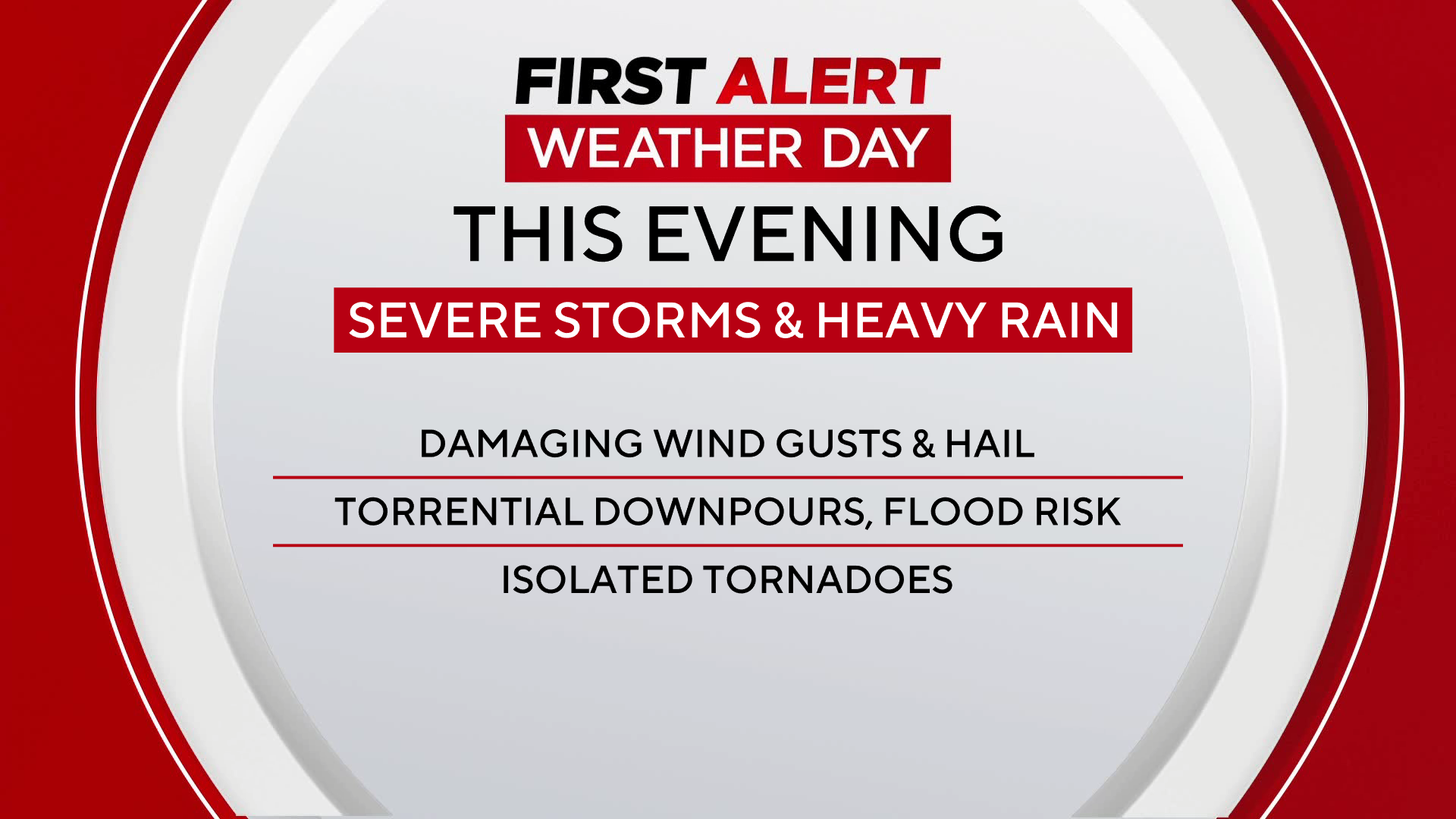
Severe storms surge across Maryland Friday evening

Severe weather brought flash flooding and numerous Tornado Watches to communities across central Maryland on Friday night.
Heavy rain with severe storms prompted an alert day.
Tornado Warnings
Just before 7 p.m., a Tornado Warning was issued by the National Weather Service for Central Maryland, expected to last until 7:30 p.m.
However, around 7:30 p.m., the Warning was extended until 8:00 p.m. in the Laurel, Beltsville area.
The NWS advised residents of Southeastern Howard County, Eastern Montgomery County, and Northern Prince George's County to take cover and move to a basement or an interior room on the lowest floor of a sturdy building.
A Warning was also issued around 8:45 p.m. that lasted until 9:15 p.m. for central Maryland, specifically Howard and Anne Arundel Counties.
Later in the evening, Tornado Warnings emerged in Queen Anne's, Kent, and Cecil County.
Flood watch issued for all of central Maryland
A Food Watch was in effect for Howard, Anne Arundel, Baltimore, Carroll, Harford, and Cecil counties, along with Baltimore City. Portions of western and southern Maryland were also under a Flood Watch.
At 9:48 p.m., a flash flood warning took effect until 4 a.m.
If you encounter flood waters, please do not attempt to cross them. The water may be deeper than you think. "Turn around, don't drown." A few high water spots could linger into Saturday morning, where the heaviest rain falls.
Gusty winds arrive in Maryland tonight
A round of strong winds was possible overnight, as an area of low pressure passed by the state. Winds may have been gusty, even outside of any showers and storms. Wind gusts of 35 to 50 mph were possible between 1 a.m. and 6 a.m. Saturday. Strong wind gusts may have knocked down trees and caused more power outages. The gustiest winds quickly eased by 8 a.m. Saturday.


