Severe weather threat returns to North Texas as weekend begins, bringing heavy rain and gusty winds

Thursday morning started cloudy and stormy for some across North Texas. By the afternoon, sunshine peaked through the clouds and highs topped out in the upper 80s with winds from the south around 5 to 10 mph. Storms are not likely Thursday night, however, this weekend there will be an uptick in activity.
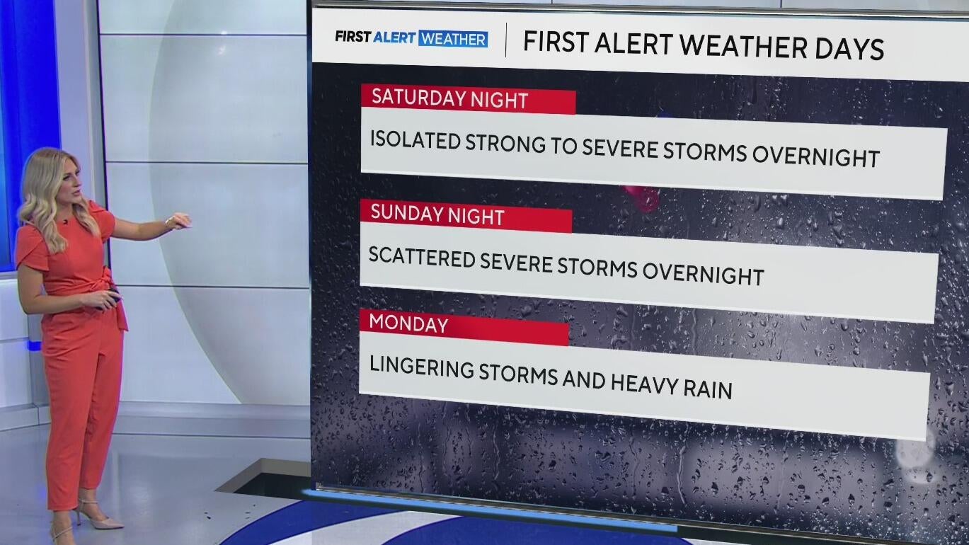
First Alert Weather Days are in effect for Saturday overnight, Sunday overnight, and Monday.

Friday, Some storms will be possible along the Red River Valley. In those spots, the Storm Prediction Center has highlighted an isolated and scattered threat.

Most of us should stay dry on Friday and during the daytime on Saturday and Sunday.

It is the overnight forecast that seems concerning for large hail, damaging winds, and flooding on both Saturday and Sunday night.


Rainfall totals will add up over the next week with some areas picking up 4"-5" of rain. The flooding threat will increase heading into early next week.

The active weather pattern continues into the next week. A cold front that moves through Monday will eventually stall and bring more storms into the coming week.


