Cloudy, cooler Wednesday follows night of storms and heavy rain in North Texas

Wednesday is looking cool and cloudy across North Texas.
After a night of heavy rainfall, North Texas gets a short break before more rain returns.
How much did it rain in Dallas-Fort Worth Tuesday night?
Overnight storms cleared from Dallas-Fort Worth shortly after midnight, leaving flooding due to heavy rain in their wake.

There were several reports of roads closed due to flooding around Rowlett, Plano, Garland and Sachse. Looking at the rainfall totals, it's no wonder with the high rainfall rates and slow-moving storms.

North Texas gets a short break from the rain
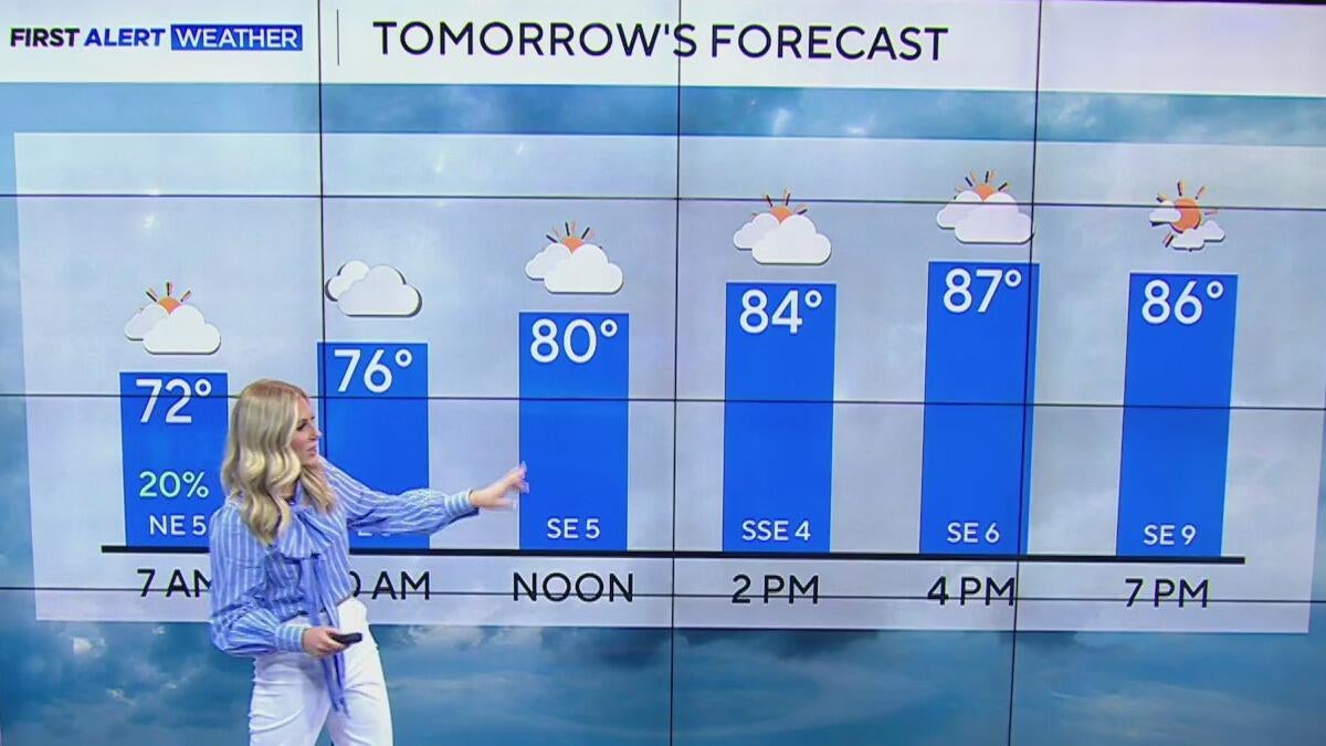
Wednesday marked the coolest day in North Texas since mid-May, as high temperatures topped out in the upper 70s and lower 80s across the metroplex.
This kept us around 10° cooler than normal for this point in the year.
As we head into Thursday, parts of the region are expected to wake up to some patchy fog, thanks to wet soils and significant moisture in the air.
We'll also be looking at isolated shower chances as a cluster of showers and storms makes a run at our western counties.
After a night of heavy rainfall, North Texas gets a short break before more rain returns.

Far from a washout, and most of the shower activity does look to weaken as it heads into North Texas.
Friday looks mainly dry, just warm and muggy, as temperatures return to the low to middle 90s. Our Red River counties will be looking at isolated shower chances, but the rest of North Texas is looking at a mainly dry day.
Saturday starts dry and warm. Highs top out in the middle 90s, with high humidity.
By Saturday evening and into Sunday, we'll be looking at the threat for scattered thunderstorms.

The Storm Prediction Center is already highlighting the northern portions of North Texas for the threat of stronger storms during this timeframe.

Our weather pattern then remains fairly unsettled as we get into the next week.


