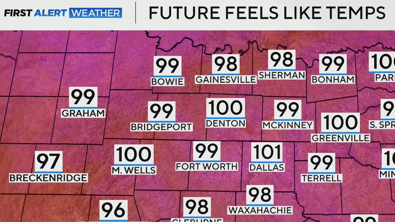
Chance of showers, storms return to North Texas as temperatures remain in the mid to high 90s

We're looking at a few isolated to scattered storm chances this Wednesday evening, as a cold front moves into North Texas and stalls out.
The bulk of that shower activity looks to stick closer to the Red River, which is where we'll watch the threat for a few strong to severe thunderstorms, primarily carrying the threat for damaging wind gusts and hail.
The timeframe for this looks to be between about 7 p.m. and midnight.
As we head into Thursday, we're looking at a very similar day. Some cloud coverage to start, with just an isolated shower chance, then clearing into the afternoon.
Juneteenth forecast will be a warm and humid one, which is a trend through the end of the weekend.

Mid-level ridging builds across the U.S. through the end of our extended period, which means the heat, humidity, and mainly rain-free weather stick around for North Texas.
Keep the shades and the sunscreen handy, and make sure you're staying hydrated.


