Maps show U.S. air quality and Canada wildfire smoke forecast


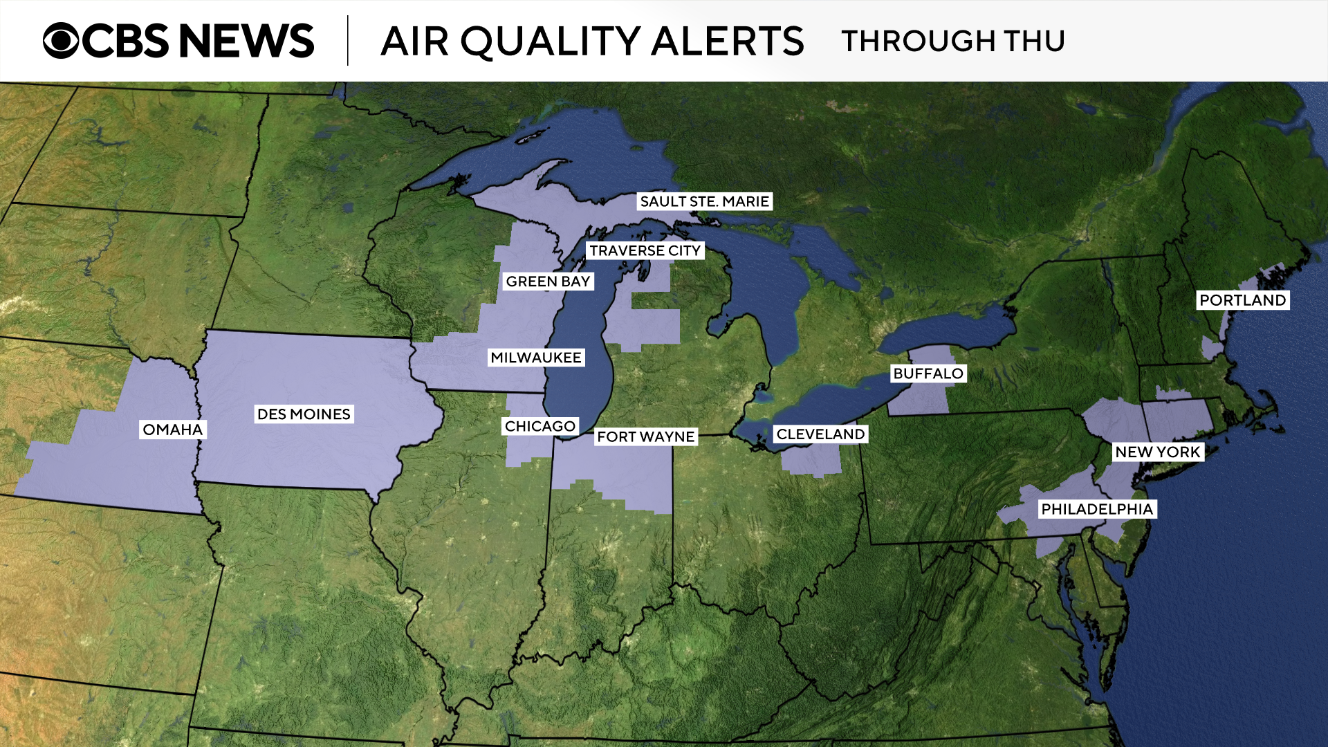
An air quality map shows conditions across the United States on Thursday as Canadian wildfire smoke is forecast to continue to impact parts of the country, prompting air quality alerts and advisories in multiple states.
The map shows parts of Illinois, Indiana and Michigan were facing unhealthy air as of Thursday afternoon, according to a federal measurement system called the Air Quality Index. Minnesota and Wisconsin had experienced unhealthy air Wednesday and the days prior.
The air index has six ratings:
- Good
- Moderate
- Unhealthy for sensitive groups
- Unhealthy
- Very unhealthy
- Hazardous
Sensitive groups include those who have a heart or lung disease, as well as older adults, children and pregnant women.
Air quality advisories or alerts were issued for several states, including Wisconsin, Michigan and Illinois, as well as New York, Massachusetts, Connecticut and parts of Maryland, according to the .
Here's a look at where alerts will be in effect through Thursday.
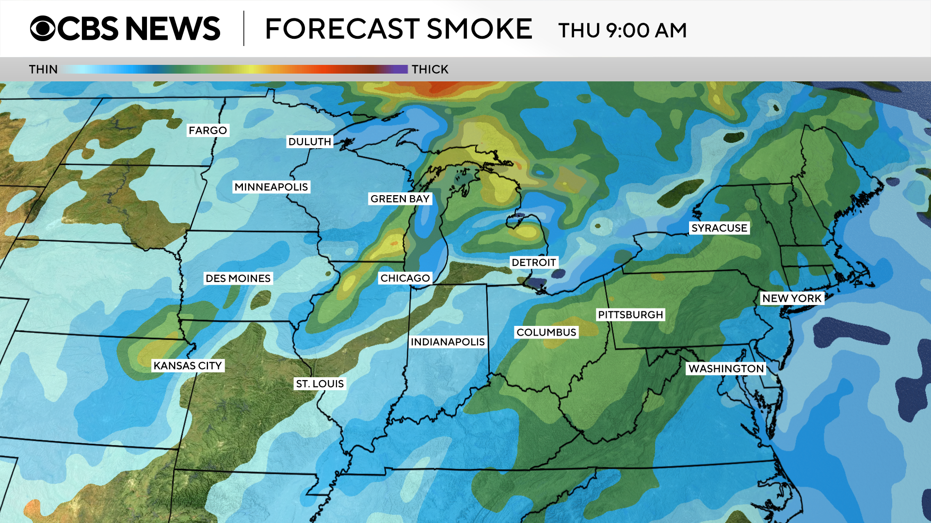
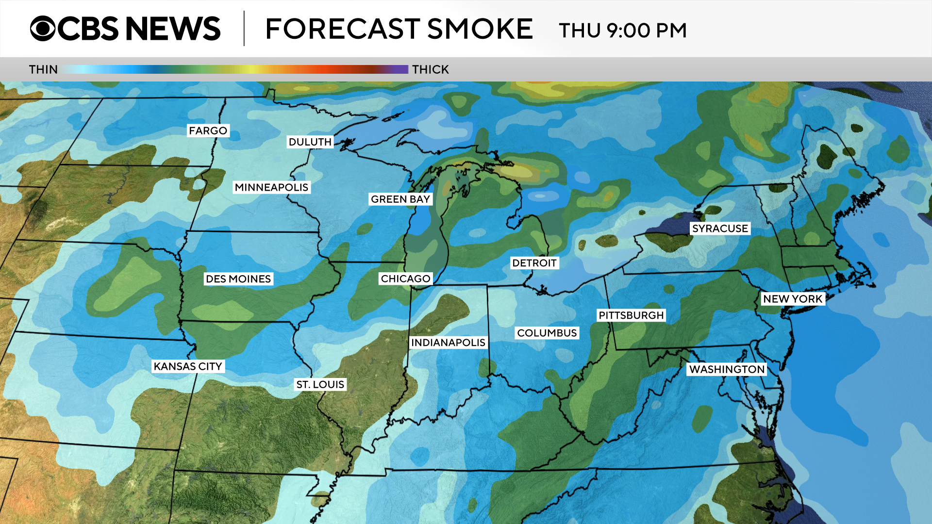
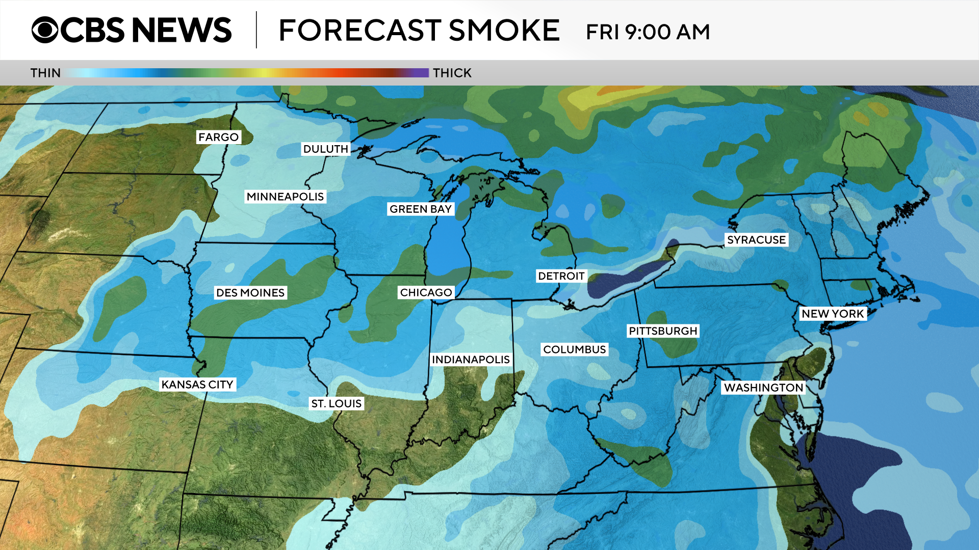
Wildfire smoke could be visible in other areas but may not impact air quality.
The smoke is expected to have less of an effect over the next few days. These maps show where the smoke is forecast to move through Friday morning.
More than 200 fires are burning in Canada, with over 100 of them considered out of control, according to the . Tens of thousands of residents across three provinces have been evacuated due to the blazes.


