Heat advisory in Philadelphia region after morning fog lifts; chance of gusty evening storms

Don't be fooled by the dreary and relatively mild weather conditions early this morning — the sunshine, heat, and humidity will return in the Philadelphia area by this afternoon.
After a cloudy and foggy start with temperatures in the 60s, a warm front will push north of the area by lunchtime, clearing the clouds and allowing the sunshine to make a return for the second half of the day.
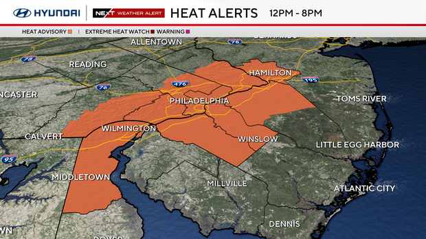
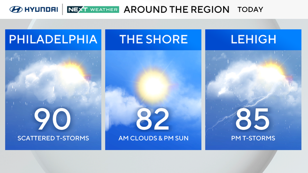
Temperatures will soar into the upper 80s to near 90 degrees, but so will the humidity, making it feel more like the upper 90s to near 100 degrees once again. These feels-like temperatures have prompted a Heat Advisory for the urban corridor in the Philadelphia area from 12 p.m. to 8 p.m.
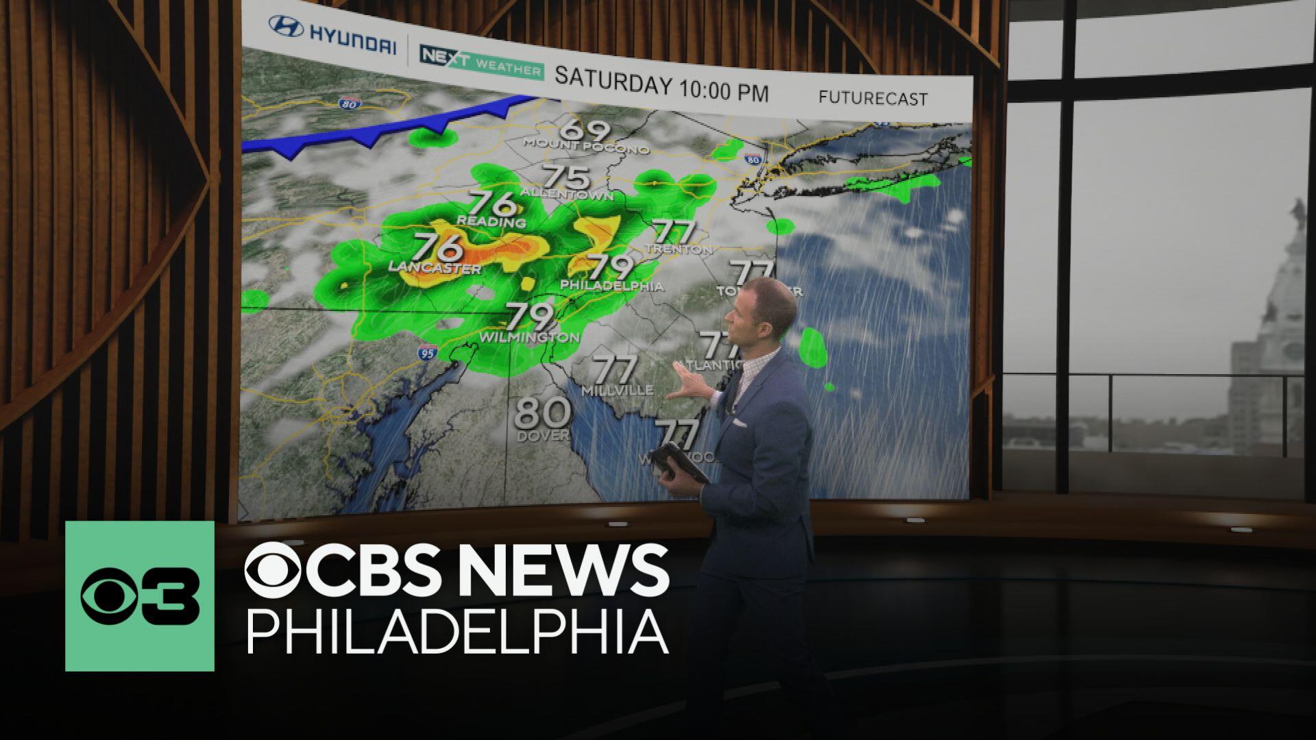
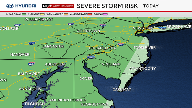
Later this evening, showers and storms will start to develop and roll in from the northwest ahead of an approaching cold front. These storms will have the potential to produce heavy rain and gusty winds.
As a result, most of the area has been put in a Marginal (1 out of 5) risk for severe weather. The greatest risk for severe weather will be over the Lehigh Valley, with the storms likely beginning to weaken as they track east toward Philadelphia and into South Jersey.
Most of the rain should dissipate by midnight and give way to clearing skies as temperatures settle into the low-to-middle 70s early Sunday morning.
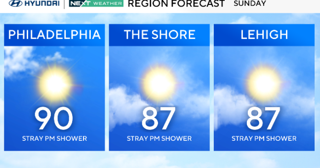
Sunday stays hot, with highs near 90, but it won't feel quite as muggy. Whether you're staying in the city or relaxing down the shore, it's shaping up to be a solid day to soak in the sun.
The breeze off the water will help a bit at the beach, and overall, it looks like a quieter day weather-wise before low 90s and storms return on Monday.
Fourth of July Forecast
Next week will be fairly similar day to day with heat, humidity and pop-up storms from time to time.
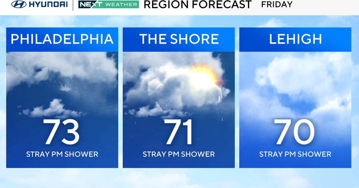
Looking ahead to Friday, your July 4 plans should be rain-free if models hold. Our NEXT Weather team will keep you posted.
Here's your 7-day forecast:
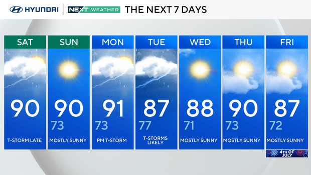
Saturday: P.M. thunderstorm. High 90, Low 68.
Sunday: Partly sunny. High 90, Low 73.
Monday: Back to the 90s. High 91, Low 73.
Tuesday: Thunderstorms are likely. High 87, Low 77.
Wednesday: Mostly sunny. High 88, Low 71.
Thursday: Mostly sunny. High 90, Low 73.
Friday: Mostly sunny. High 87, Low 72.