Heat wave begins in Philadelphia region today, bringing dangerously high temperatures

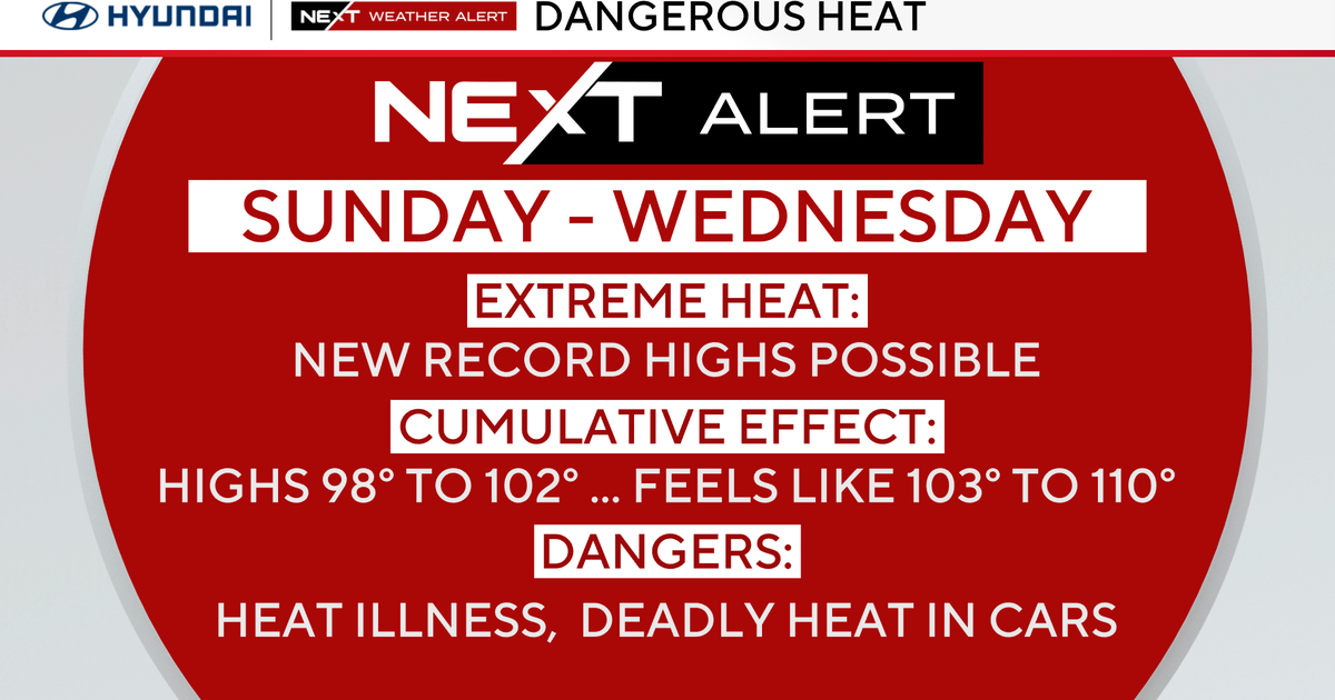
The official heat wave will begin today, following yesterday's fall just below the 90-degree mark, thanks to the spotty storms. Expect Monday to approach 100 degrees in many areas across the Delaware Valley, which would mark the first time since July 7, 2012.
Heat index values will likely reach 110-plus at the height of the day thanks to dewpoints in the 70s. Along the immediate coast, it'll be a bit cooler, but even inland sections of shore towns may reach over 100 on the heat index.

At these temperatures, heatstroke and heat exhaustion are possible. The cumulative effect of the extreme heat from Saturday to Wednesday can lead to additional health problems.
Due to the dangerous heat, a NEXT Weather Alert is in effect now through Wednesday.

It is likely we will set a number of new record highs each day, and some new record highs for the low temperatures at night.
There is a chance of isolated pop-up storms each day, simply due to the heat and humidity. Some storms could briefly turn severe with wind, hail, downpours and lightning as the main threats.
Air quality won't be great either, and additional air quality alerts may be issued before the end of the week. On Wednesday, the heat dome begins to degrade slightly, allowing a better chance for showers and storms, some of which may briefly become strong or severe. Intense downpours will also be possible.

Heat warnings, advisories, air quality concerns
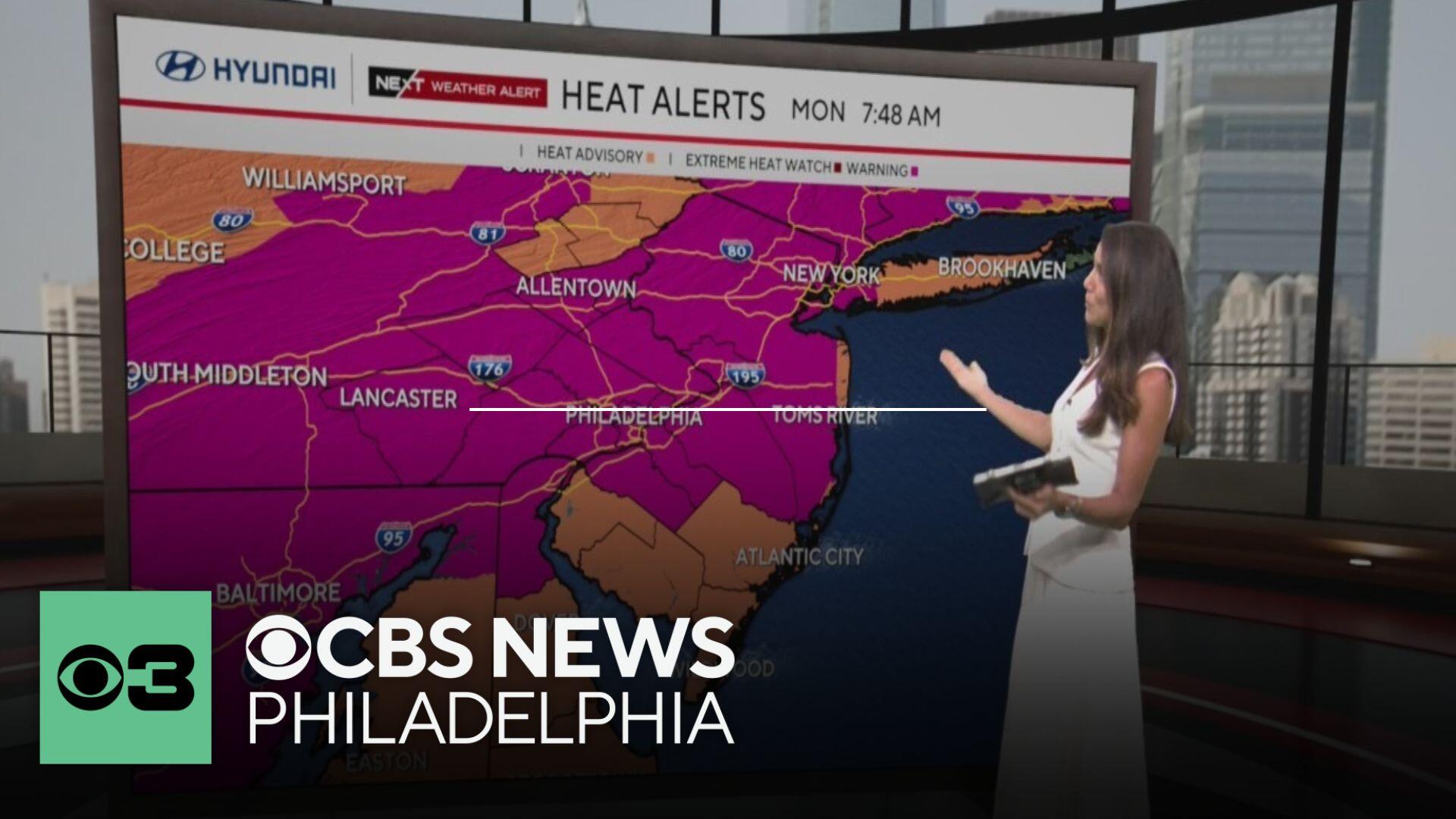
Multiple weather alerts and advisories are in effect because of the heat wave.
- Extreme heat warning: An extreme heat warning is in effect now until Wednesday evening for all of Pennsylvania, New Jersey and Delaware counties along the Interstate 95 corridor.
- Heat advisory: A heat advisory is also in effect now until Wednesday evening for South Jersey away from I-95, the Jersey Shore, southern Delaware and the Poconos.
- Air quality alert: There is also a code orange air quality alert in effect in Philadelphia, Ocean County and southeastern Burlington County. The elderly, small children and those with respiratory problems should stay indoors as much as possible. Concerned about the air quality in your neighborhood? Check out to see how conditions are in your area.

How to stay cool in Philadelphia
The City of Philadelphia's Department of Public Health has declared a heat health emergency, effective now through Wednesday night. The emergency could be extended if the forecast changes and this heat wave continues.
, the city has activated its emergency heat programs, including Philadelphia's Corporation for Aging's Heatline, cooling centers, home visits by special field teams and enhanced daytime outreach for those experiencing homelessness.
A full list of , spraygrounds and pools in Philadelphia is available .
Tips for surviving the heat wave
Make sure to hydrate with nonalcoholic and non-sugary drinks. Spend time in the air conditioning, and if overheated, try a cool shower.
Never leave people or pets in a car; the heat builds quickly, and it can be deadly in minutes. Check on family and friends.
Finally, keep pets indoors or in a shaded area with clean, cool water. Don't walk dogs on the hot pavement; their paws can burn.
Heat wave facts
- Last year's first heat wave lasted from June 18 to 23, and the most recent heat wave of 2024 occurred at the end of July. Both topped out at 98 degrees.
- Our last 100-plus degree day? July 7, 2012, when we hit 101 degrees.
- And the longest heatwave on record? A whopping 12 days back in 1901, including two scorchers over 100 degrees.
Here's your 7-day forecast:

Monday: NEXT Weather Alert for extreme heat. High 100, Low 79.
Tuesday: NEXT Weather Alert for extreme heat. High 102, Low 79.
Wednesday: NEXT Weather Alert for extreme heat. High 99, Low 80.
Thursday: Scattered storms. High 89, Low 79.
Friday: Scattered storms. High 82, Low 71.
Saturday: Scattered storms. High 87, Low 72.
Sunday: Cloudy skies. High 86, Low 72.