Renewed flood risk Thursday in Minnesota before steamy weekend

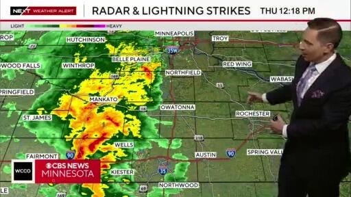
Thursday morning starts with another round of heavy rain targeting southern and eastern Minnesota into western Wisconsin.
Rainfall totals of 1 to 3 inches are possible, especially in areas that received several inches on Wednesday. There is a NEXT Weather Alert in effect from Interstate 94 on south, as there is a combined threat for additional flooding and severe weather.
The National Weather Service has issued a flood watch across southern Minnesota. The Twin Cities could experience flash flooding if the area sees about an inch of rain in the span of three hours or less.
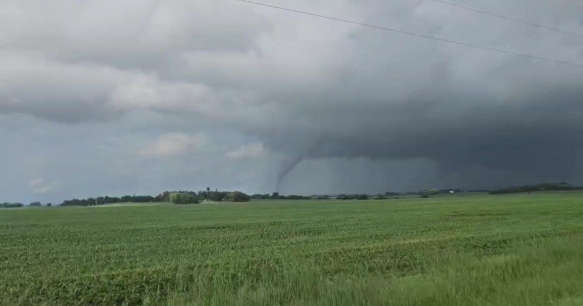
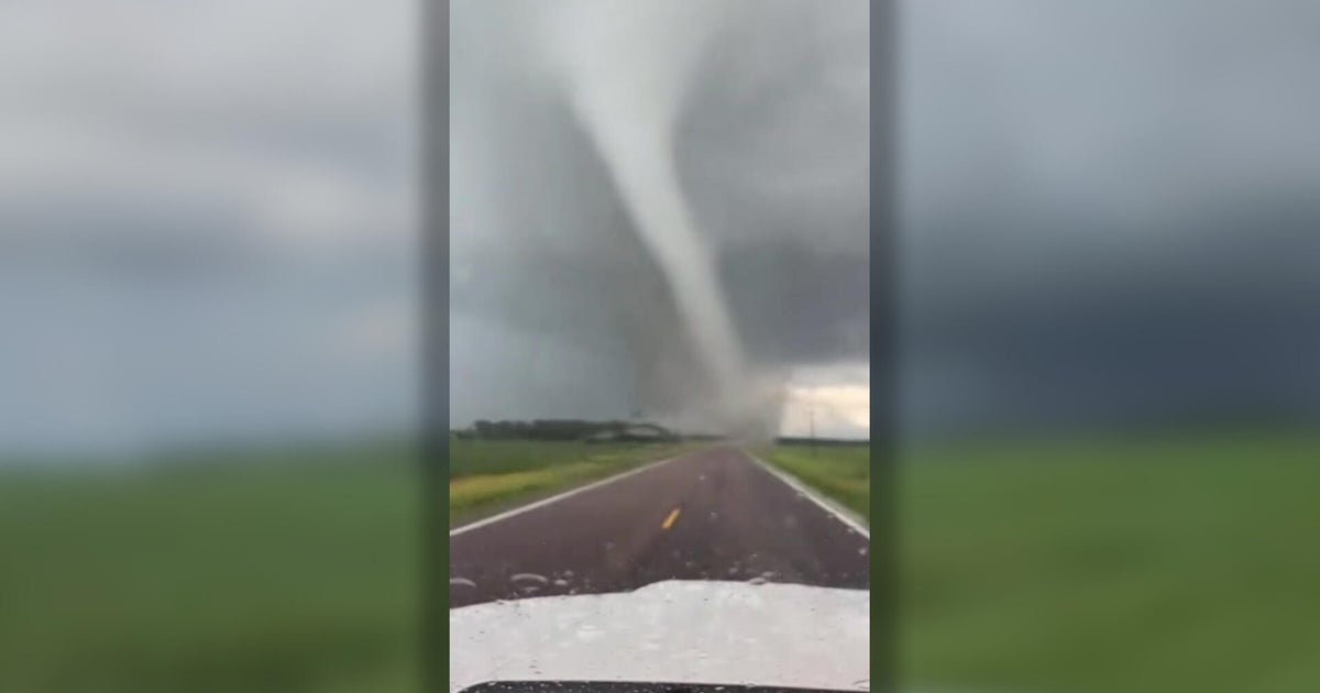
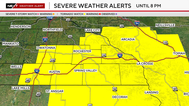
Parts of Minnesota — ranging from Rochster to western Wisconsin — are also under a tornado watch until 8 p.m.
Most of the rain clears out by Thursday evening with a dry and warmer Friday ahead. Temperatures now to the point of the mid 70s.
Heat and humidity surge this weekend with storm chances Saturday and Sunday, possibly severe.