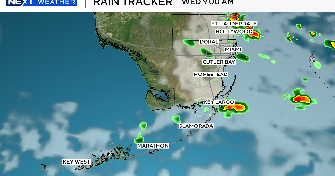
Spotty storms across Miami-Dade, Broward

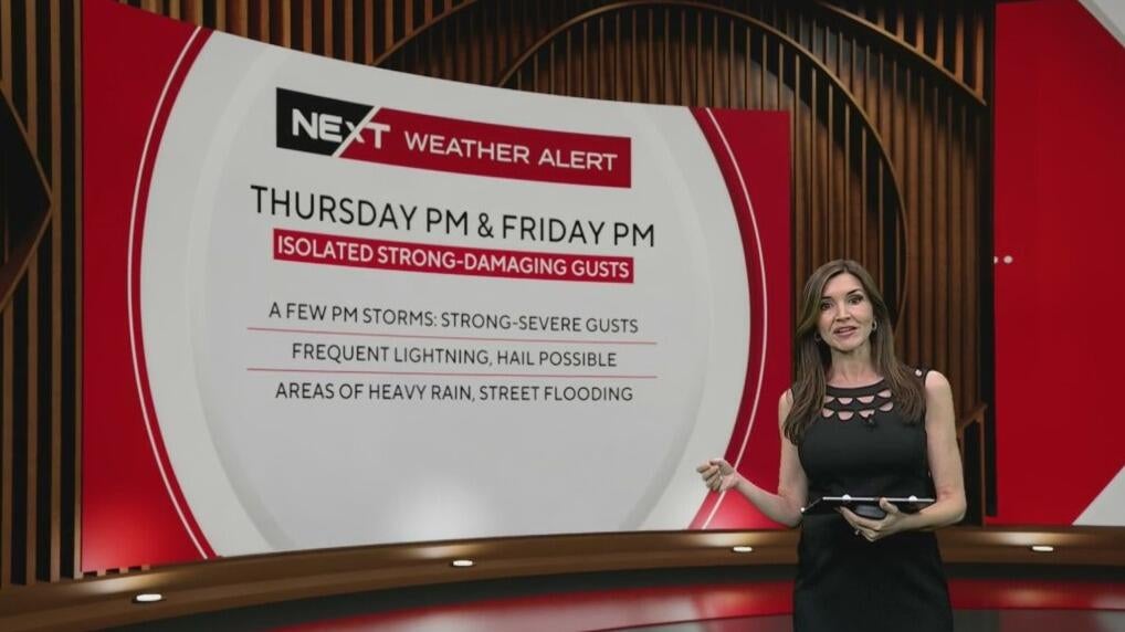
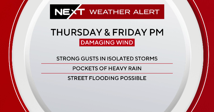
The NEXT Weather Team has canceled a NEXT Weather Alert for Thursday and Friday. It was originally issued due to the potential for storms with heavy rainfall and damaging winds.
On Thursday, the first round of rain arrived in the morning with scattered showers and storms, but they were not severe. A second round was scheduled to arrive around noon and last through the afternoon. A few of the storms may produce strong to marginally severe wind gusts, lightning and hail, according to NEXT Weather meteorologist Lissette Gonzalez.
On Friday, the most active period for storm activity will be in the afternoon, with a few producing strong to marginally severe wind gusts.
The storm activity stems from an upper level low centered across the Florida peninsula which allows a much more unsettled pattern, according to NEXT Weather Chief Meteorologist Ivan Cabrera. While the low will remain well north of South Florida, a moist southeast flow will continue to pull in deep moisture.
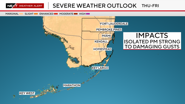
The has placed all of South Florida under a "marginal" (Level 1) risk for strong storms. The concern is that the storms may also contain damaging wind, and the slow-moving rainfall increases the chance for isolated street flooding.
South Florida will remain unsettled Friday through the weekend, and even into early next week, due to another upper-level low will approach the state late in the weekend into early next week which will provide additional support for showers and storms. All of this will result in above normal rain chances each day.
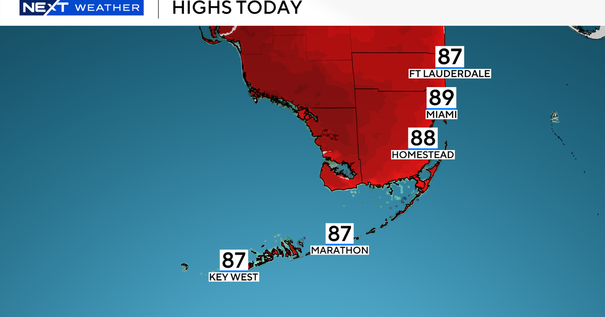
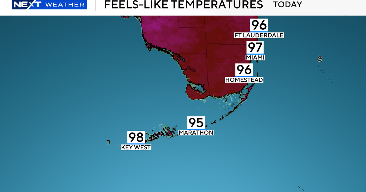
Afternoon highs will remain in the upper 80s with feels-like temperatures in the triple digits.