Heavy rainfall, damaging winds threaten Miami, Broward on Thursday and Friday


The NEXT Weather Team has issued NEXT Weather Alert for Thursday and Friday due to the potential for storms with heavy rainfall and damaging winds.
A weak upper level low with deep moisture remains over our region.
On Thursday, a surface flow will begin to weaken which will slow down the sea breeze storms. This will impact the coastal metro areas in South Florida before activity pushes inland later in the afternoon and evening.
NEXT Weather Chief Meteorologist Ivan Cabrera said a localized heavy rain threat may materialize across urban areas if persistent heavy rainfall occurs.
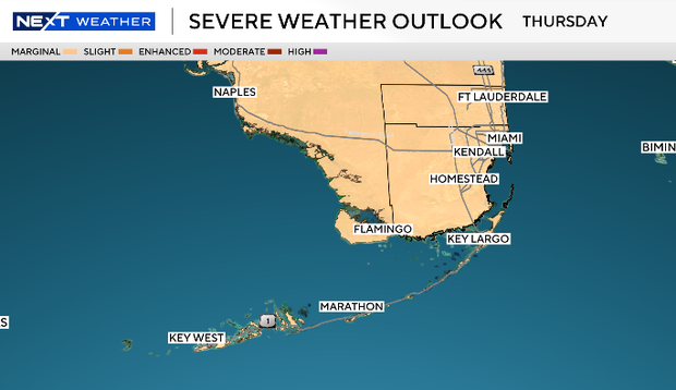
The has placed all of South Florida under a "marginal" (Level 1) risk for strong storms on Thursday and Friday. The concern is that the storms may also contain damaging wind, and the slow moving rainfall increases the chance for isolated flooding.
On Thursday, the most active period for the storms will be from noon to 5 p.m. On Friday, the most active period will be from 1 p.m. to 5 p.m.
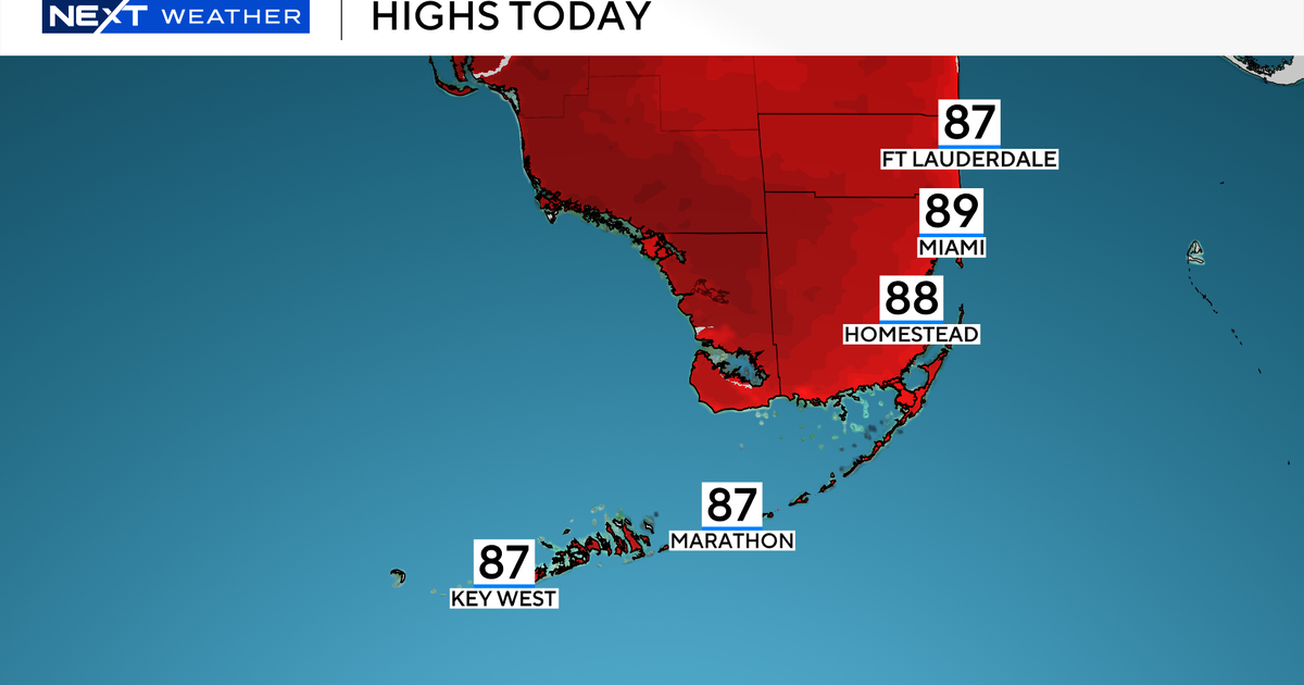
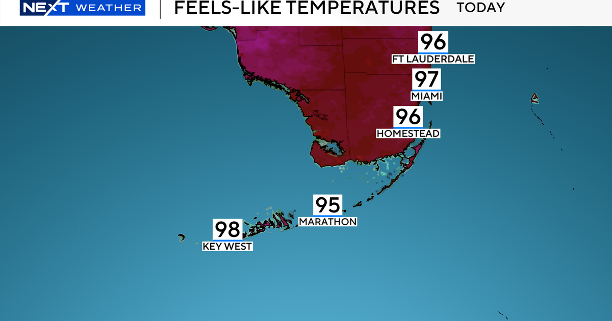
The upper low pulls away Friday and into the weekend which will lower the chance of rain. Afternoon highs will remain in the upper 80s with feels-like temperatures in the mid to upper 90s.