Anatomy of a hurricane: Meet the NOAA pilots and planes flying into the storm

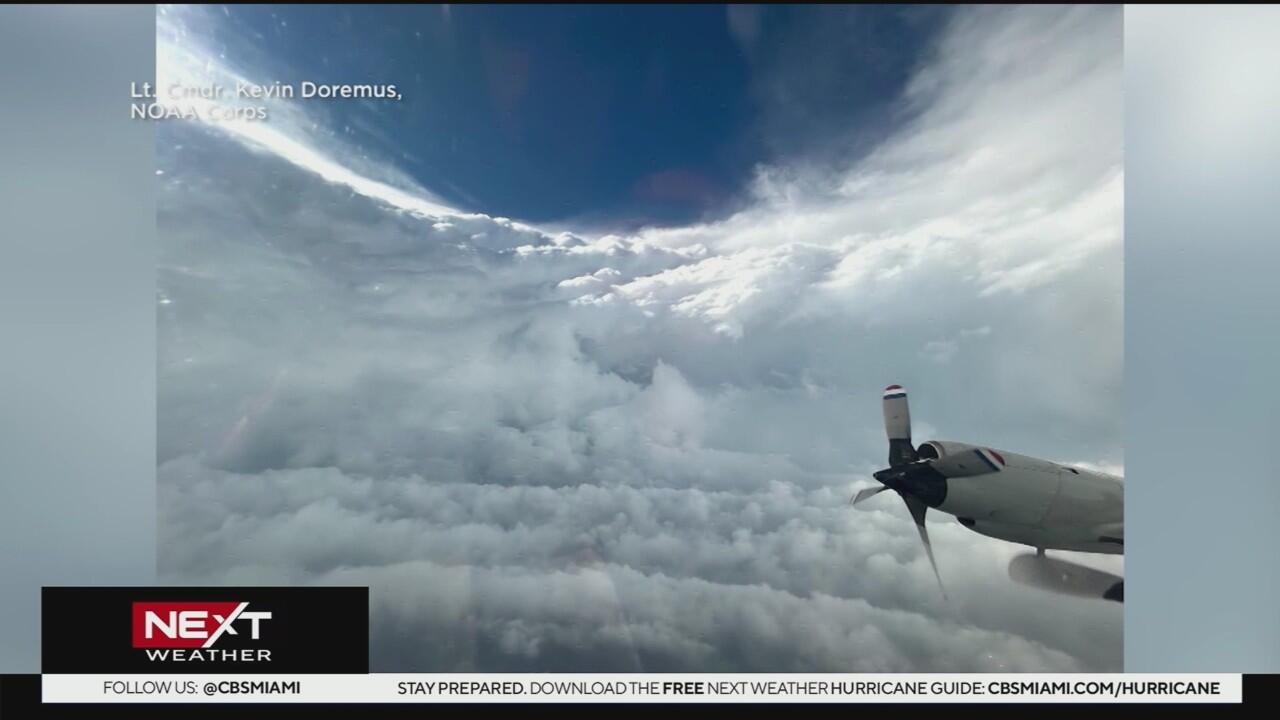
At first glance, the sitting quietly inside a hangar at the National Oceanic and Atmospheric Administration's facility appears unremarkable. But when a hurricane begins swirling in the Atlantic or Gulf, this aircraft becomes one of the most important tools in storm forecasting: It flies straight into the heart of the storm.
For NOAA pilot Andrew Reeves, now entering his second year as a hurricane hunter, the experience is anything but ordinary.
"A good way to think of it is riding an old wooden roller coaster through a car wash," said Reeves, standing outside the aircraft he's trained to pilot directly into tropical cyclones.
What is a hurricane hunter plane?
The WP-3D Orion is part of the NOAA's Hurricane Hunter program. These aircraft are essentially flying laboratories, packed with instruments designed to gather high-resolution data in places where traditional weather stations can't go — like the middle of a developing hurricane.
"What weather stations are in the middle of the ocean? None, right?" Reeves said.
As the plane cuts through high winds and torrential rain, it collects critical information on cloud structure, wind speeds, atmospheric pressure, and humidity levels. This data is transmitted back in real time to the National Hurricane Center (NHC) to improve forecasts and help meteorologists better understand storm dynamics.
How Hurricane Hunters collect storm data
Among the many tools onboard is one particularly important device: the . This instrument is deployed from a tube on the plane and free-falls through the storm, transmitting data as it descends.
"It measures temperature, wind, pressure, humidity," said electronics engineer Steven Paul. "These are critical in data collecting. The data we collect with these gets input into the models the forecasters use to forecast."
The real-time information from these sensors is what helps meteorologists refine the forecast cone that viewers see on TV during hurricane season. Every storm the aircraft flies into makes future forecasts just a little bit more accurate.
Who creates the hurricane forecast cones?
Back on land, that data is analyzed by some of the top forecasters in the world at the NHC.
"I know many of them, they are world-class people," said Jamie Rhome, deputy director of the NHC. "They do an amazing thing not only for the National Hurricane Center but for our community as a whole."
Each mission is staffed by both experienced pilots and NOAA scientists who work together to ensure they fly into the most valuable parts of the storm for data collection.
New technology expands the mission
This year, NOAA is deploying unmanned aerial systems (UAS) alongside its crewed flights, which will allow for even more comprehensive data collection.
"We will have more unmanned aerial systems launching inside the storm," said Reeves. "That allows us to remain inside the eye for longer collecting more data." These drones can fly into areas of the storm too dangerous or turbulent for a manned aircraft, effectively expanding the coverage zone for NOAA's observations.
Why hurricane hunters matter more than ever
With climate change influencing the intensity and behavior of storms, the work of hurricane hunters is more crucial than ever. More accurate data leads to better storm models, earlier warnings, and potentially, lives saved.
Despite the inherent risks and turbulence, Reeves says he wouldn't trade his job for anything. "It's the greatest flying job there is."