Hurricane forecast cones don't show the full picture. Why inland threats can be devastating.

As Hurricane Milton demonstrated, a storm's impacts can stretch far beyond its center or the forecast cone. That's why meteorologists urge residents to pay attention to more than just the projected track — especially as the hurricane season grows more intense.
What the hurricane forecast cone shows and what it doesn't
When a hurricane is out over the ocean, meteorologists primarily focus on the , which maps out where the center of the storm is expected to track over the next five days. It's a critical tool for anticipating landfall zones, but experts say it doesn't capture the full scope of a storm's reach.
Once a hurricane approaches land, forecasters begin to shift attention from just the cone to the broader impacts on the surrounding region. That's because damaging effects, like heavy rain, tornadoes and power outages, can occur well outside the cone.
Hurricane Milton: A cautionary example
Hurricane Milton, which churned through the Gulf in early October 2024, serves as a stark reminder of the risks beyond the cone.
While its forecast track pointed toward the Gulf Coast, South Florida experienced a rash of tornadoes that developed in the storm's outer rainbands — a full day before the hurricane made landfall.
"These storms developed a good distance from the forecast cone," the NEXT Weather team reported, highlighting how far-reaching tropical systems can be.
Rain bands tied to hurricanes can spawn severe weather events, including tornadoes and strong winds, many miles from the storm's center. Such events can knock out power for days, sometimes even weeks, regardless of whether the core of the storm comes close.
"Increasingly we are seeing these outages for days and weeks," said Jamie Rhome, deputy director of the . "A lot of people struggle to understand they can lose power for that long and what they would do."
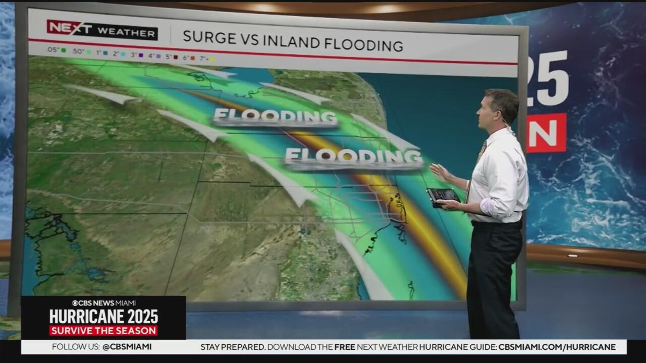
Inland flooding poses another hidden risk
Another underappreciated hazard is , which can be triggered by bands of tropical rain repeatedly moving over the same area. While most public attention focuses on storm surge, flash flooding from heavy inland rain can block roads, damage homes, and trap residents for days.
"If you stocked up and did your due diligence… you can confidently stay in your home for 1-2 days as those flood waters subside and not put yourself in danger in those conditions," Rhome said.
Having enough food, water, and essential supplies for a multi-day stretch can eliminate the need to wade or drive through floodwaters in the aftermath of a storm, conditions that can endanger both you and first responders.
A new hurricane forecast cone is coming
In response to these far-reaching hazards, the National Hurricane Center plans to roll out an experimental version of the hurricane forecast cone in 2026. This new format will not only show the storm's projected path but also include inland hazards like wind, flooding, and the potential for tornadoes.
The goal: make sure people understand that even if they're far from the forecast track, they're not necessarily safe from harm.
As Hurricane Milton showed, the cone is just one piece of the puzzle. To truly stay safe, residents must monitor the entire system's impacts, no matter how far removed they may seem.


