South Florida under a flood watch until 8 a.m. Wednesday

After flooding rain on Monday, Tuesday is another wet day as our flood risk continues.
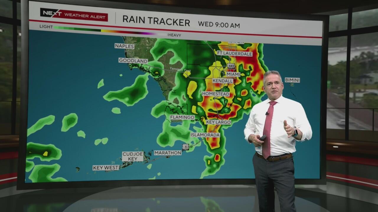
The NEXT Weather team has issued a NEXT Weather Alert through Wednesday morning.
Heavy rain is expected to continue moving in from the south in waves with additional flooding likely as ground is saturated.
The National Weather Service reports South Florida saw 2 to 4 inches of rain on Monday, with some isolated areas nearing 8 inches. It said similar amounts are expected on Tuesday and could impact areas hit hardest on Monday.
Miami-Dade, Broward and Monroe counties are under a flood watch through 8 a.m. Wednesday. There is a slight (level 2 out of 4) risk for flash flooding on Tuesday, according to the NWS.

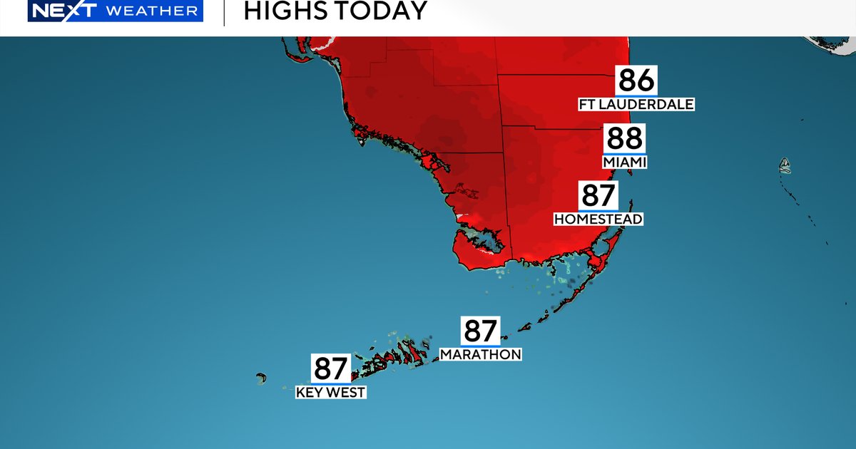
On Tuesday, scattered showers and storms will be possible all day, but the potential for heaviest rain will be in the afternoon and evening. Highs will be in the low 80s.
On Wednesday, the chance of rain is 60-70% with showers and possibly thunderstorms. New rainfall amounts between a half and three quarters of an inch are possible. Afternoon highs will be in the low to mid-80s. Winds will be a bit breezier from the southeast at 15 to 20 mph
The chance of rain goes down throughout the workweek as Saharan dust moves into South Florida. Scattered showers and storms will still be possible, but it will trend drier with rain chances around 50% each afternoon.
Afternoon highs gradually climb for the back half of the workweek and weekend as temperatures return to the upper 80s and lower 90s on Thursday through the beginning of next week.
The weekend will be partly cloudy with roughly a 50% chance for scattered afternoon showers.