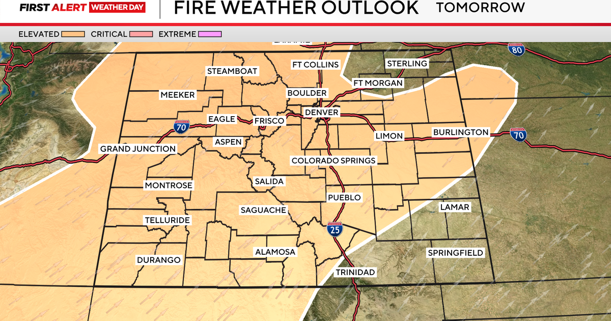
Severe storms in Colorado on Tuesday may bring large hail and isolated tornadoes

Strong to severe storms are expected along the I-25 corridor and across the eastern plains of Colorado on Tuesday.

Storm development is likely between noon and 2 p.m. across the high country and foothills, with storms pushing east through the afternoon and evening. For the Denver metro area, the main window for severe weather runs from noon to 5 p.m., with a lingering threat through 9 p.m. near the far eastern border.

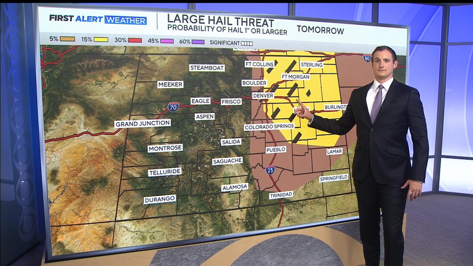
All types of severe weather are possible, but the biggest concern is large hail, up to 2 inches in diameter or more.
That includes areas from Castle Rock to Fort Collins, and north toward the Wyoming state line. A brief tornado or two can't be ruled out.

Storms will be fueled by strong surface heating and dew points well into the 60s, providing plenty of moisture to work with.