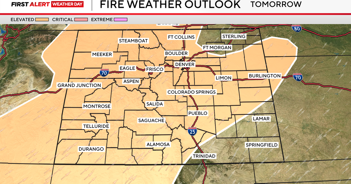
Cold front brings relief from record heat and renews severe storm threat in Colorado

A cold front will move through overnight Sunday into early Monday, bringing much-needed relief from the heat across Denver and much of Colorado.
This front will lead to two big changes for the week ahead: cooler temperatures and the return of storm chances.
Highs will be stuck in the 70s and 80s from Monday through Thursday—a refreshing change after the recent stretch of record heat.
Scattered thunderstorms will also return to the forecast. Strong to severe storms will be possible on both Monday and Tuesday.
Monday will bring garden variety showers for most of the area, with a slight chance for one or two storms to produce hail and gusty winds near Denver.

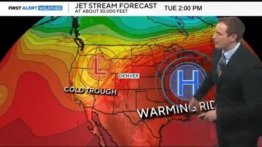
Tuesday will bring a greater threat of severe weather. Damaging winds and large hail will be the main concern along the I-25 corridor and across the Eastern Plains.

Storms are expected to develop between 1 and 2 p.m., gaining strength as they move east through the evening hours.