Stormy weather possible on last day of heat wave in Maryland Thursday

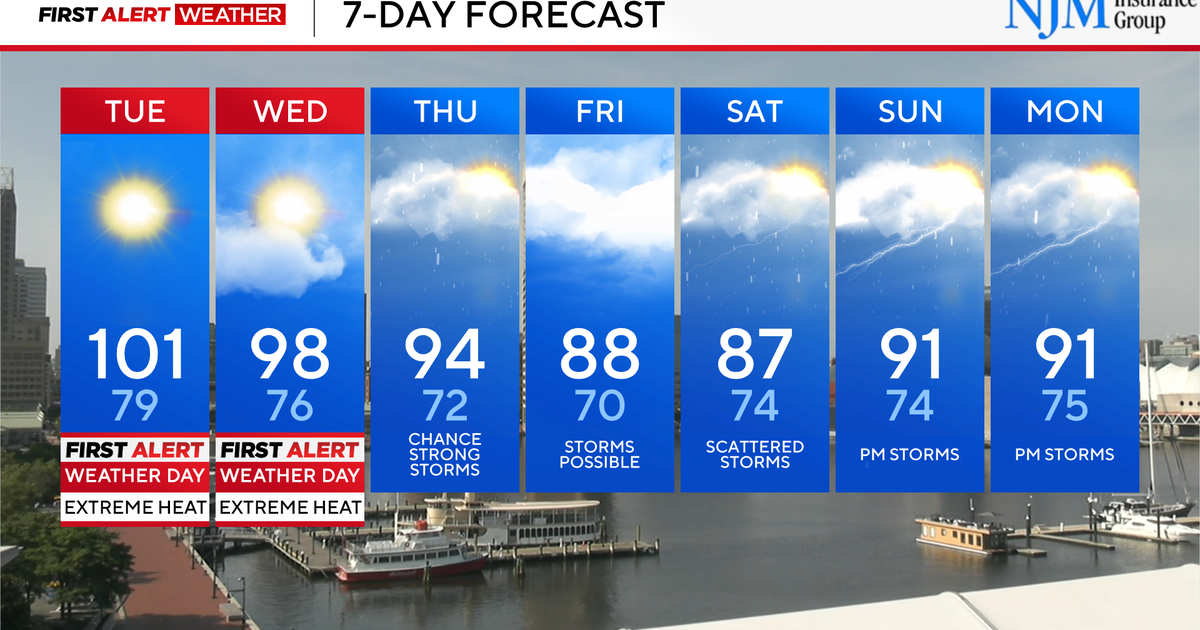
Stormy weather is possible in Maryland Thursday as a heat wave continues to bring temperatures in the low 90s. Feels like temperatures will reach 100° to 105°.
Everyone is advised to continue taking heat precautions, as heat index temperatures will approach dangerous levels midday through afternoon. Baltimore City has declared a Code Red extreme heat alert through later today.
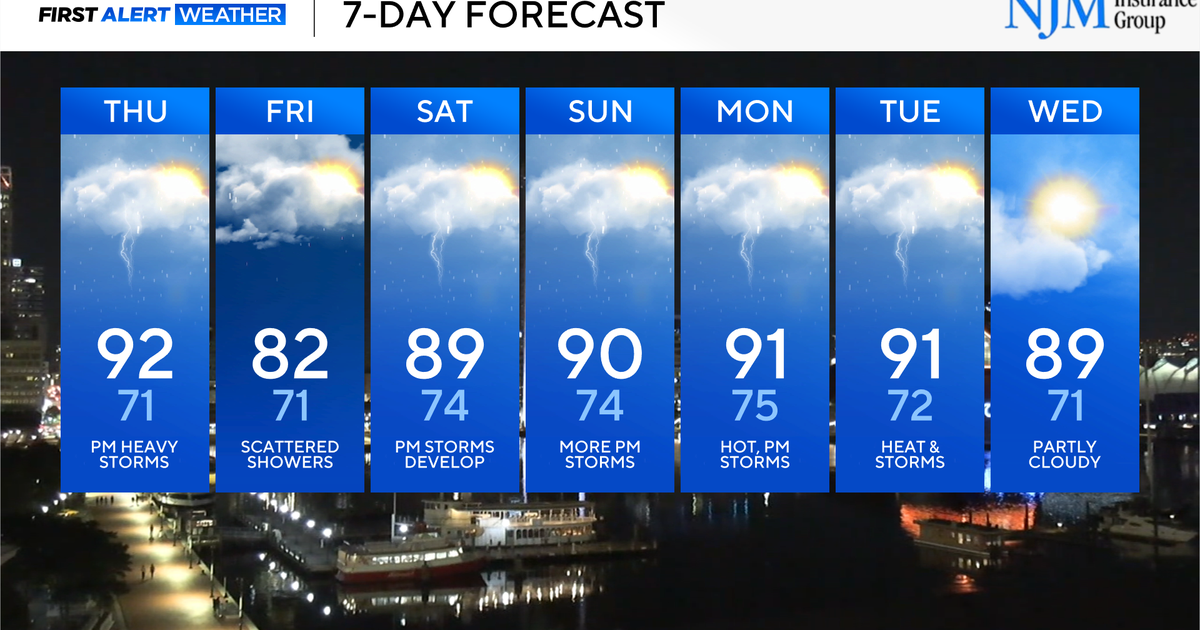
Major relief awaits us Friday when high temperatures in many of our neighborhoods will fall shy of 80°
Heat, humidity, stormy weather in Maryland
Sunny skies early Thursday will allow temperatures to quickly heat up into the lower to middle 90s. While record heat is not forecast today, the heat will still be tough on us and our pets.
With high levels of humidity, feels like temperatures will range from 100° to 105° for most of us. Everyone is advised to take frequent breaks in the A/C and drink plenty of water.
Isolated to scattered strong to severe storms will develop anytime today, but especially after lunchtime. The most numerous strong storms should be between 3 p.m. and 11 p.m.
A few storms could produce drenching downpours, very intense lightning, gusty winds, and hail. Widespread severe weather isn't likely, but a few storms could be severe with wind gusts up to 60 to 65 mph.
Remember to keep a close eye and ear out for rapidly changing weather conditions. When thunder roars, head indoors.
Heat alerts in Maryland
A heat advisory is in effect for central Maryland until 7 p.m. Thursday. Feels like temperatures will approach 105° (and a handful of neighborhoods could surpass that mark) across the WJZ Viewing Area.
Even though extreme heat warnings have been lifted, the heat can be dangerous, especially to the sick and elderly when the feels like temperature surpasses 100°.
Staying cool during Maryland heat wave
Here are a few ways to stay safe and healthy while working outside during extreme heat:
- Wear loose-fitting, light colored clothing
- Avoid being in the direct rays of the sun
- Take frequent breaks if you plan to be outdoors
- Drink lots of water, even if you don't feel thirsty. Two liters of water a day is recommended
- Remember pets and the elderly in the heat
- Make sure ceiling fans are circulating counterclockwise to circulate cooler air downward
Major relief Friday
Behind the cold front that eases through our area later today and tonight, much cooler weather filters into most of Maryland. Friday will be cooler as the cold front continues to sink south of us. High temperatures may not reach 80° for areas along the Bay, Baltimore City, and most of northeast Maryland. There is another chance of showers and storms Friday. Rain coverage remains spotty.
Summer weather weekend in Maryland
The upcoming weekend will be seasonably hot and muggy.
Expect variable clouds, with hot and muggy weather. Scattered thunderstorms will develop during the afternoon and evening hours. These storms will be of the hit-or-miss variety. Not every neighborhood will get wet. Neighborhoods that do receive storms could receive locally heavy rainfall, cloud-to-ground lightning and gusty winds.
Temperatures peak in the upper 80s and lower 90s both weekend afternoons. It'll feel hotter when mugginess is factored in.