Hazy skies continue as heat and humidity build across Maryland

Canadian wildfire smoke will keep skies hazy overnight across Maryland, with temperatures falling into the 50s and 60s. While the smoke will be visible, most of it will remain at high altitudes and have little impact on air quality at the surface.
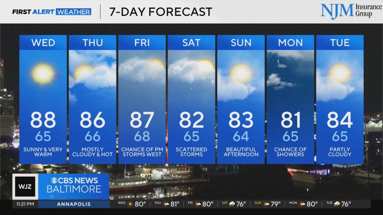
Wednesday will bring more sunshine and continued haze as the upper-level smoke persists. Temperatures will soar into the upper 80s to near 90 degrees. Some locations may hit the 90-degree mark for the first time this year.
The heat continues Thursday, but cloud cover will increase, and humidity will become more noticeable. Highs will again push into the upper 80s, with a muggy feel returning to the atmosphere.
Friday will feature a mix of sun and clouds, with a few isolated storms possible across western Maryland late in the day. Baltimore and the I-95 corridor are expected to stay dry. Afternoon highs will reach the mid to upper 80s.
The best chance for widespread rain arrives Saturday as a cold front pushes into the region. Expect scattered showers and a few storms, with highs cooling slightly into the upper 70s to low 80s.
The front will move out of the area by early Sunday, setting the stage for a beautiful end to the weekend. Sunshine returns Sunday afternoon with lower humidity and highs in the low 80s.
Looking ahead, the weather turns unsettled again next week. Showers and thunderstorms are possible Monday and Tuesday, with highs near 80 degrees each day.
Forecast confidence drops beyond Sunday, so stay tuned to WJZ for updates as we continue to refine the timing and coverage of next week's rain chances.


