Sunny Saturday gives way to possible rain Sunday in parts of North Texas

Meteorological spring wrapped up with a classic end-of-May day. Friday's high of 88 degrees matched the historical average for May 31. As the month closes, the tally shows more days with below-normal highs than those above average.

This spring, covering March, April, and May, goes down as the seventh warmest on record and the 52nd wettest. As we approach the start of meteorological summer at midnight, the astronomical summer solstice remains 20 days away. While the majority of our tornado activity (about 55%) typically occurs during the 61 days of April and May, June still brings its share of severe weather. It ranks as our second stormiest month.

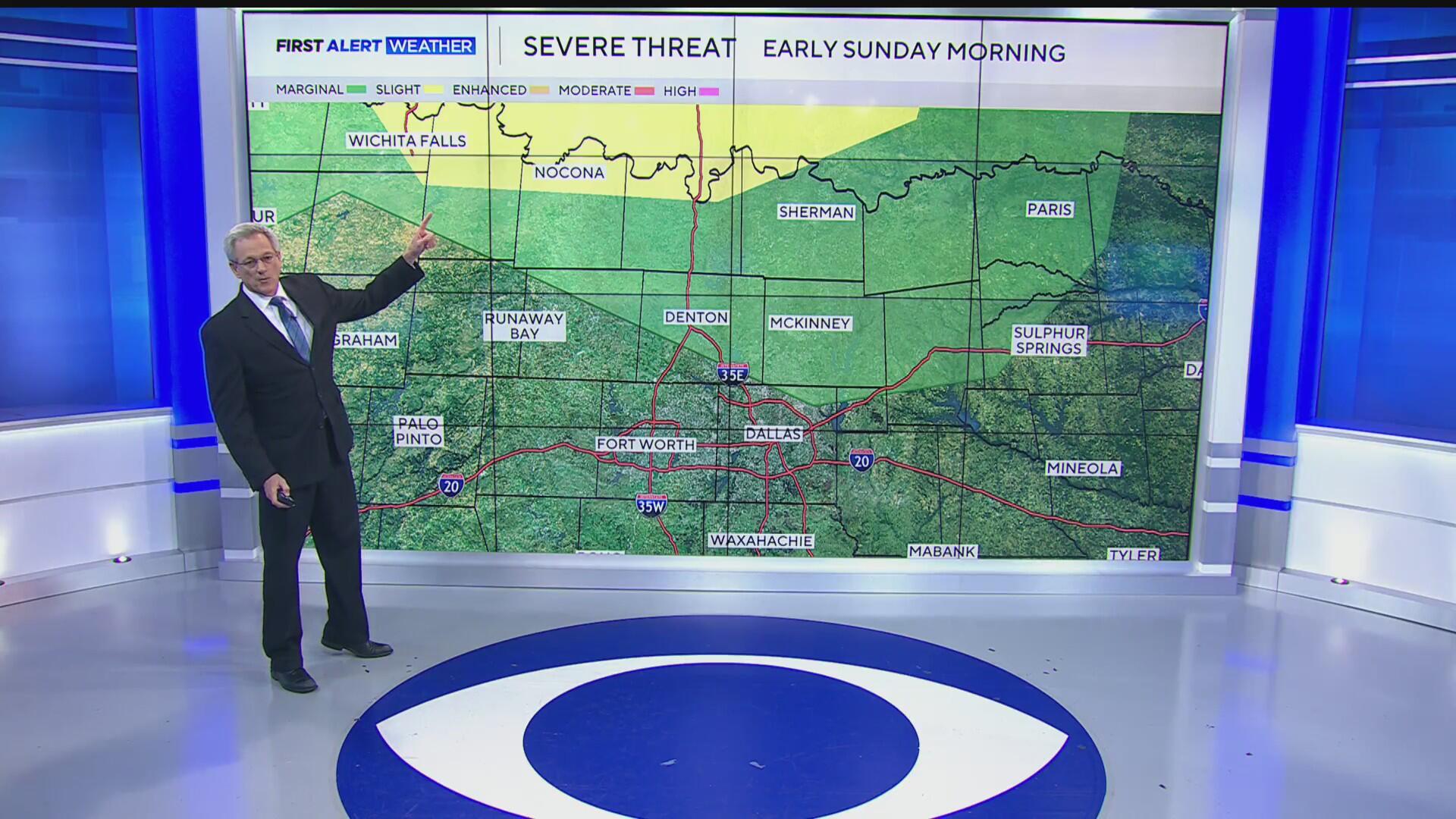
It's no surprise that June is kicking off with two chances for storms on its very first day. The first round poses a lower risk and is expected to arrive overnight from the north. Storms will cross the Red River in the early morning hours and gradually weaken as they move across our eastern counties through the morning.

The risk for damaging winds and one-inch hail remains low and does not include the Metroplex.

By afternoon, the remnants of the boundary will linger over our southern counties. With the addition of daytime heating, conditions will be favorable for new storm development.

These storms carry a significantly higher risk of producing damaging winds and large hail. A 'slight' risk - Level 2 out of 5 - has been issued for areas south of the Metroplex, including Johnson and Ellis counties.

We'll be monitoring for hail up to two inches in diameter, or larger, roughly the size of an egg. This threat is expected to develop by late afternoon and continue into the early evening.

More unsettled weather is expected through the first week of June. The First Alert Weather Team is closely monitoring Tuesday night, Wednesday, and Wednesday night for the potential designation of First Alert Weather Days. Storm chances are likely to persist into next weekend.


