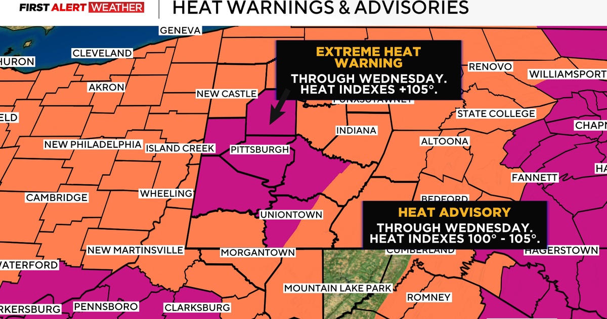
Extreme heat warning in western Pennsylvania prompts First Alert Weather Day

In case you've lost count, today is going to be the third 90-degree day in a row for Pittsburgh. The extreme heat will be in place through the weekend.
Now, our highs will likely dip closer to 90 degrees starting Wednesday, but morning lows will remain elevated and warm enough that they won't allow those without air conditioning units to fully recover from the day-to-day rigors of hot weather being in place. Cool showers are one of the best ways to help your body cool down if faced with relentless heat.
The reason for the heat is a powerful ridge of high pressure that is right on top of us right now. This ridge will begin to drift to the south over the next 24 hours, putting us on the edge of the ridge, or what they call the "ring of fire." It sounds ominous. In some ways, it is as the "fire" part of the phrase references storms that develop during the afternoon on the periphery of the ridge each and every day.
The edge today is just north of I-80, and that's where there is a small severe weather chance today. The edge moves on top of our region on Wednesday. This means temperatures will likely quickly warm up to the 90s, but then with storm development, will likely remain at or below 90 degrees behind any early afternoon storms. This pattern will be in place from Wednesday through Saturday, and will likely be enough that we will not see an extension of the Extreme Heat Warning now in place through Wednesday.
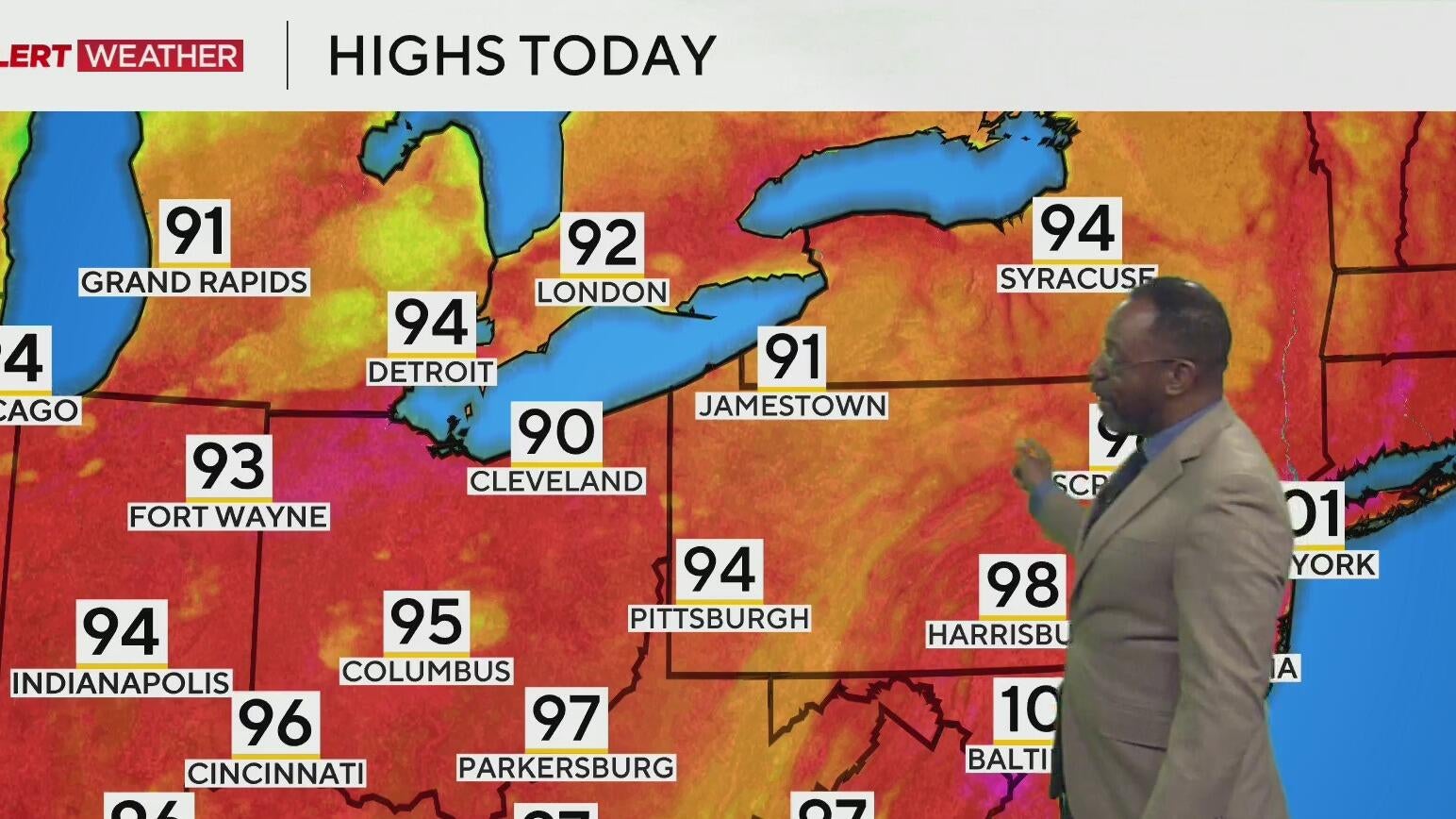
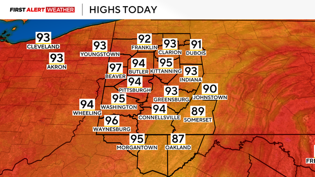
Getting back to your forecast, highs today will hit the mid-90s with light westerly winds. You should see plenty of sunshine today. While there is an isolated rain chance for today, rain chances will be higher the rest of this week. I have noon temperatures already in the 90s. Humidity levels will also be extreme with dew points near 70 degrees all day long. The best rain chance today comes just before midnight.
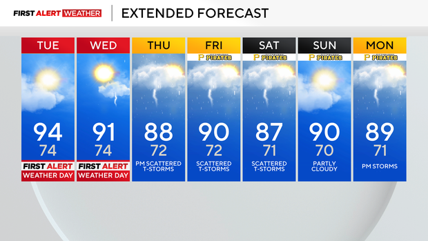
Wednesday is going to be an interesting day as storm chances will cut into the heat during the afternoon. This will bring brief relief from the heat and should keep our highs closer to 90 degrees than 95 degrees.
Rain will be spotty, but those who see it will see downpours that could potentially lead to flash flooding. I have Wednesday's rain chance higher than the rest of the week, but rain chances will remain on Thursday, Friday and Saturday.
I bring rain chances down on Sunday to isolated areas. Temperatures will remain near 90 degrees all the way through at least next Monday, with morning lows also remaining above 70 degrees through then as well.