Scattered showers, thunderstorms hit Philadelphia region Monday. Here's the weather forecast.

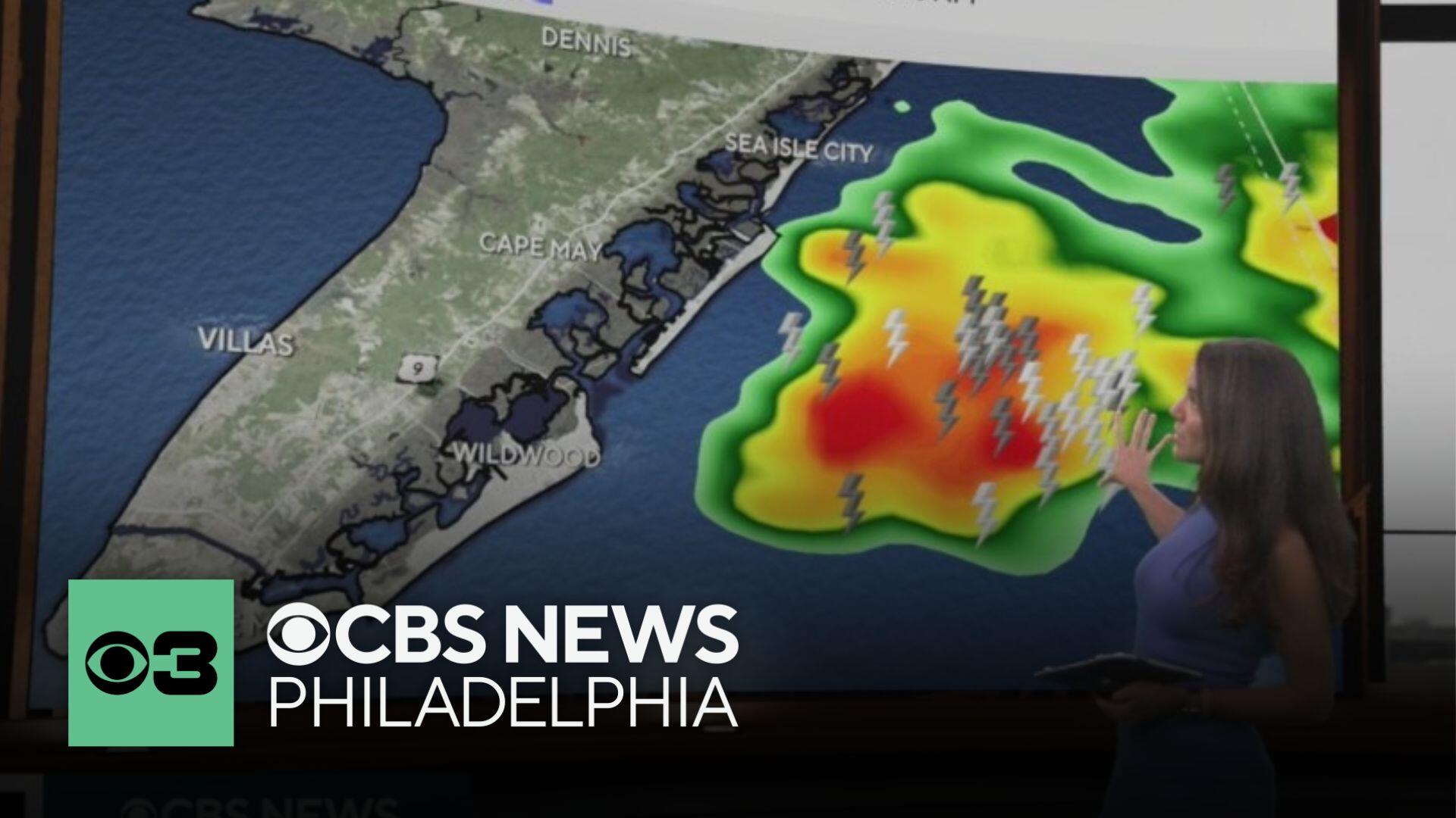
Showers and thunderstorms moved across the Philadelphia region Monday afternoon, prompting the National Weather Service to issue severe thunderstorm and flash flood warnings.
Those warnings have since been lifted, but a NEXT Weather Alert is in effect as more storms will hit the region on Monday night. They won't be quite as strong as the storms earlier, but they will bring heavy rain, the possibility of frequent lightning, and the potential for localized flooding.
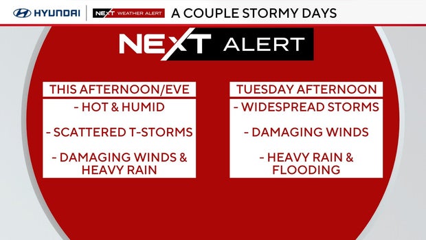
While severe weather potential is limited by marginal shear, a few stronger storms with damaging wind gusts or localized flash flooding are possible. The Storm Prediction Center has issued a Marginal Risk (1/5) for severe storms.
Tuesday brings a more active setup. The region will be fully in the warm sector with highs in the low 80s to low 90s and dew points in the 70s, supporting strong instability. A strengthening upper-level trough will push a cold front through the area later in the day.
With sunshine expected early in the day, instability will rise and conditions will support strong to severe storms. The SPC has placed most of the region in a Slight Risk (2/5) for severe thunderstorms, with damaging wind gusts as the main threat.
Alongside the severe threat, there's also a risk of localized flash flooding. Deep warm cloud layers will support heavy rainfall rates, especially if storms train over the same area. Delmarva is under a Slight Risk (2/4) for excessive rainfall, with a Marginal Risk (1/4) elsewhere.
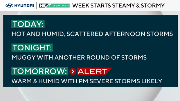
The cold front slows as it moves through Tuesday night, with lingering showers possible through Wednesday morning, especially near coastal areas. Lows Tuesday night will be in the 60s to the low 70s.
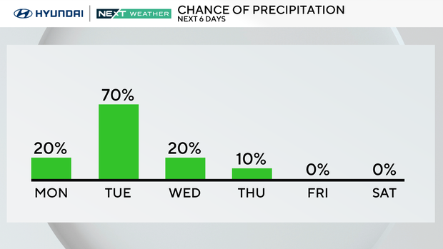
An upper-level trough lingers over the Northeast into the weekend. While Wednesday and Thursday will be warm, humidity will drop slightly behind the front. Most of Wednesday looks dry, with only a slight chance for showers Thursday near and northwest of I-78 as a weak front moves through.
July 4th on Friday and Saturday looks pleasant. High pressure will settle over the region with mostly sunny skies, highs in the 80s, and comfortable dew points in the low to mid 60s. It's shaping up to be a nice holiday weekend.
Here's your 7-day forecast:
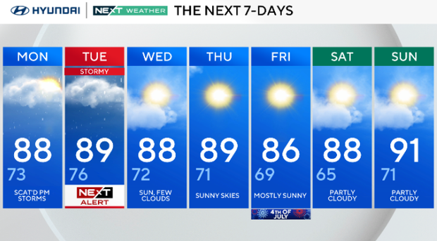
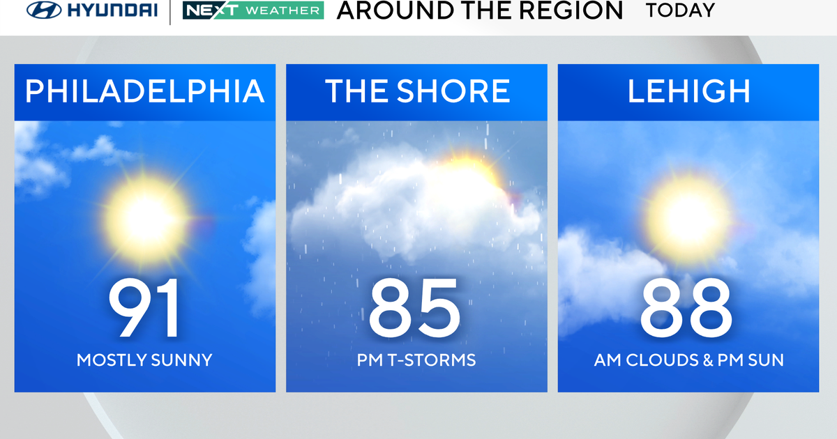
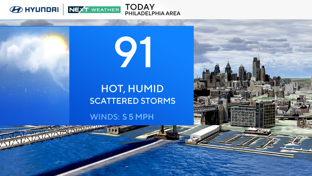
Monday: Scattered p.m. storms. High 88, Low 73.
Tuesday: NEXT Weather Alert for storms. High 89, Low 76.
Wednesday: Sun, few clouds. High 88, Low 72.
Thursday: Sunny skies. High 89, Low 71.
Friday: Mostly sunny. High 86, Low 69.
Saturday: Partly cloudy. High 88, Low 65.
Sunday: Partly cloudy. High 91, Low 71.