Hot, mostly sunny Thursday in Philadelphia region, tracking a chance of weekend rain. See the weather forecast

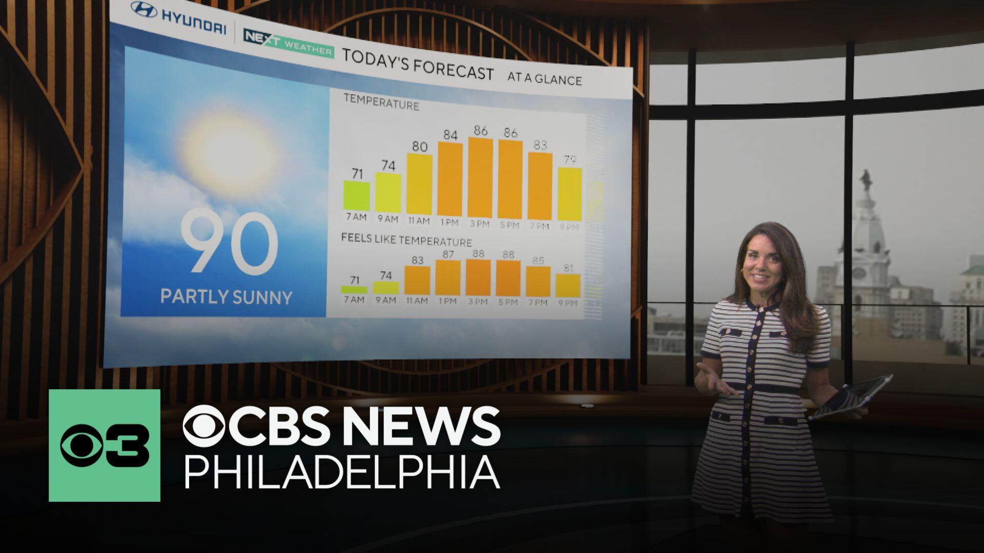
Expect hot weather on Thursday in the Philadelphia region, with the temperature approaching the 90-degree mark in many spots, sans the shore locations.
Thanks to cloud cover, we may fall just short, but we will keep an eye on how warm it gets. We just felt the hottest temperature of 2025 on Wednesday, when we reached 88 degrees — that was actually the hottest it's been since Aug. 28, 2024 (280 days ago).
No rain is expected Thursday and there are no air quality alerts.
Mostly sunny skies will be the rule with moderate air quality likely.

Friday brings a very slight cooldown and is dry to start, with highs in the upper 80s and increasing clouds as the day progresses. Then we see scattered showers and storms Friday night and into Saturday.
Saturday looks a bit unsettled: Expect a mix of clouds and sun, a drop in temperatures, and a chance of showers and thunderstorms. It's a good day to have an indoor backup plan or keep an eye on the radar if you're heading out.
Sunday looks a bit iffy, as models are still uncertain as to whether or not a front will stall or head south. If it stalls, we'll likely see showers; if it doesn't, the day should be partly cloudy and in the 70s.
We are back to the 80s beginning early next week with some off-and-on showers and storms.
Here's your 7-day forecast:

Thursday: Hot, humid. High 90. Low 64.
Friday: P.m. shower. High 88. Low 66.
Saturday: Shower/storm. High of 79, Low of 66.
Sunday: Mostly sunny. High 76, Low 65.
Monday: Shower chance. High 81. Low 63.
Tuesday: Shower or storm. High 81. Low 63.
Wednesday: Partly cloudy. High 84. Low 65.


