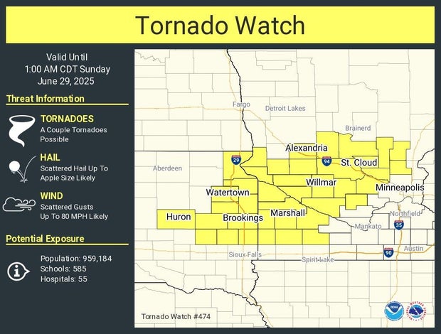
Several western counties are under a tornado watch until 1 a.m.; storms heading to metro area


Severe storms are working their way through Minnesota. A severe thunderstorm watch is in effect for northwestern Minnesota until 11 p.m.
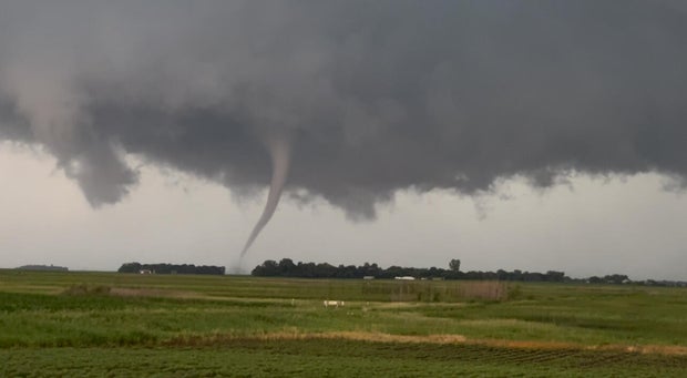
A tornado warning has been issued for Canby, Burr, Benson, Murdock and Clontarf Minnesota through 10 p.m. The Swift County Sheriff's Office posted on social media that a tornado touched down east of Holloway, Minnesota. The National Weather Service will confirm if there was a touch down.
The National Weather Service posted on their social media that a funnel cloud had been spotted near Elmdale. A Tornado warning has also been issued for that area.
A photo sent to WCCO shows what appears to be a funnel cloud near Madison, Minnesota.
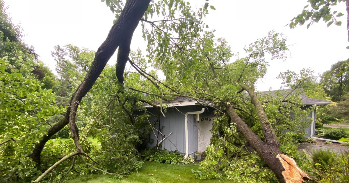
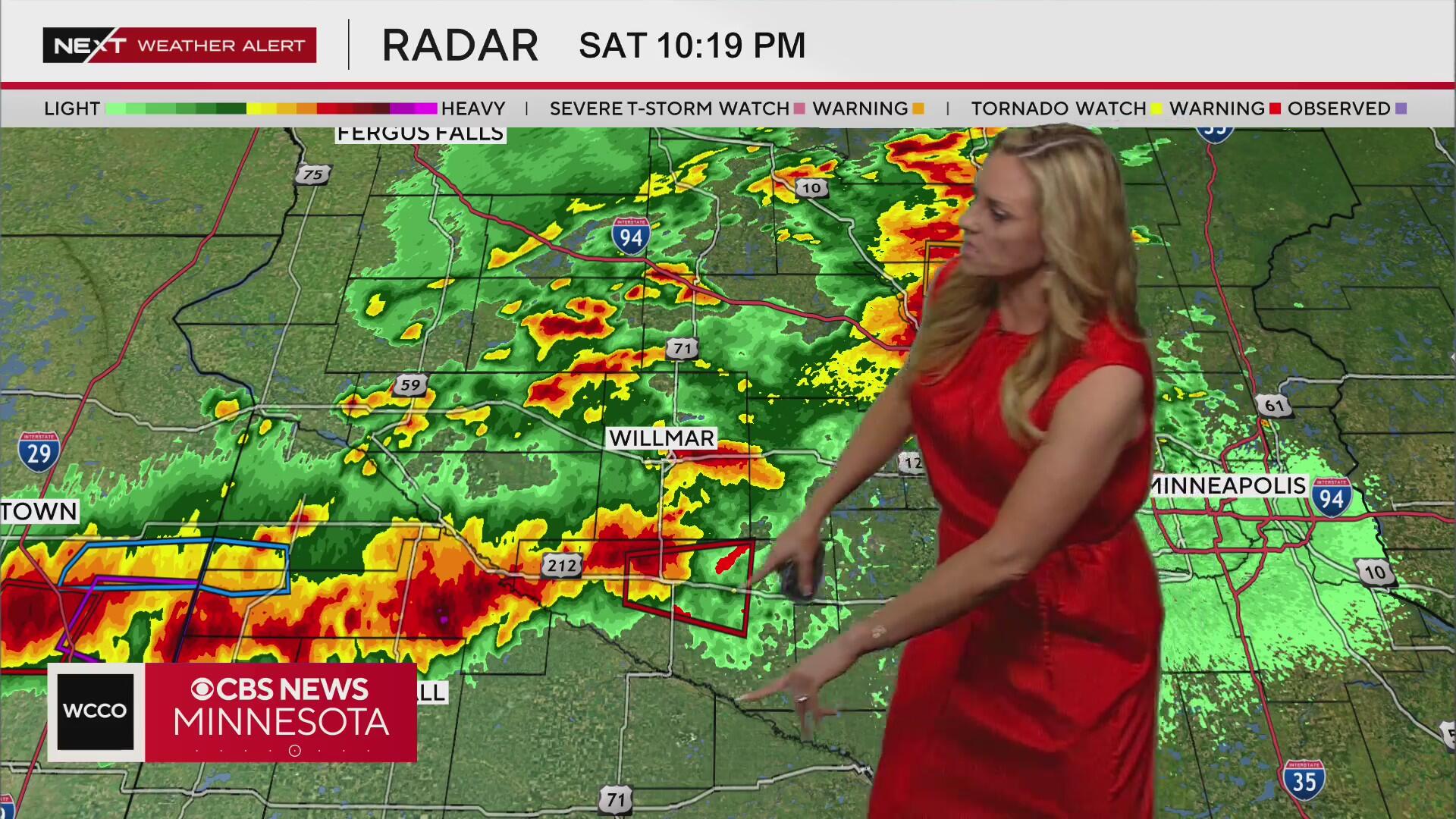
The storms will move toward the metro, hitting the area around 10 p.m. Saturday night. The biggest threat for the metro will be straight-line winds.
Several counties to the west of the Metro area are in a tornado watch until 1 a.m. Sunday.
Expect high temps a few degrees cooler Sunday in the mid-80s. Another round of afternoon storms are possible Sunday.
High pressure is back early next week, making for a sunny, seasonable start to the week. It looks like things turn stormy again toward the end of the week, with several chances for storms as we approach the Fourth of July.