Air quality alert remains for Minnesota; record heat possible Monday


Sunday is the first day of meteorological summer in Minnesota, and it will certainly feel like it.
Air quality alerts are still in effect statewide until 6 p.m. Monday due to the threat of more low-level wildfire smoke from Canada. The smoke will fluctuate in altitude, allowing for periods of reprieve, however the haze will likely persist into Monday.
Temperatures climb into the mid 80s on Sunday and low 90s on Monday, which will likely be the hottest day of the season to date, challenging daily record highs.
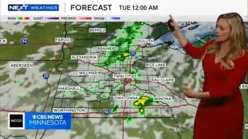
Monday night into Tuesday is when the next rainmaker returns to the Twin Cities, with some soaking rains — 1-1.5 inches — likely wrapping up by Tuesday night.
Some of the storms could be strong to severe across west-central Minnesota late Monday.
Along with breezy winds, temps will be dropping back closer to average into the 70s by the middle of the week.
Northern lights possible across Minnesota Sunday night
A severe geomagnetic storm is underway, which means northern lights may be visible — assuming skies remain clear enough — on Sunday night and possibly Monday night.


