Severe storms with large hail possible in Colorado Friday

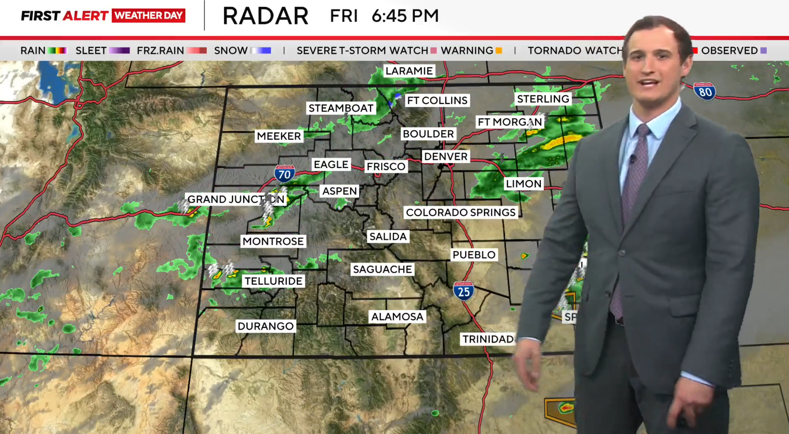
A stormy Friday is in store for parts of Colorado as the threat of severe weather looms, especially for areas east of the I-25 corridor.

A First Alert Weather Day is in place due to the potential for large hail, potentially over 2 inches in diameter, and damaging wind gusts of 40 mph or higher. The highest risk area is southeastern Colorado where tornadoes are possible.

A tornado watch was put into effect at 1:45 p.m. Friday for several counties in Colorado, including Arapahoe, Baca, Bent, Cheyenne, Crowley, Douglas, Elbert, El Paso, Fremont, Huerfano, Kiowa, Kit Carson, Las Animas, Lincoln, Otero, Prowers, Pueblo, Teller and Washington until 9 p.m.

In the Denver metro area, the severe weather threat will hinge on how quickly morning cloud cover and light showers dissipate. If skies clear by midday, additional storm development could bring strong to severe storms into the urban corridor.

Storms are expected to taper off by late evening, with gradual clearing overnight. Saturday will bring a welcome break from active weather, with mostly sunny skies and highs in the low to mid-80s.

Moisture increases again on Sunday as another disturbance pushes across the region. Afternoon and evening showers and thunderstorms are likely, with cooler temperatures in the mid to upper 70s.