Storms on Thursday could bring quick burst of intense weather to parts of Massachusetts

Thunderstorms on Thursday evening threaten to interrupt the start of what will feel like our first true summer stretch of weather in 2025.
Temperatures soar
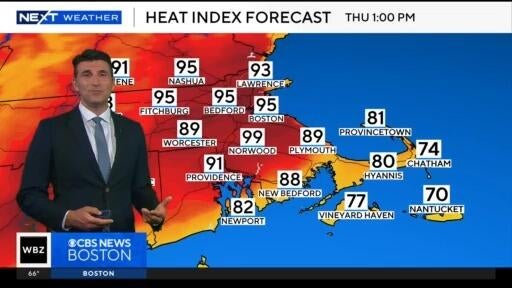
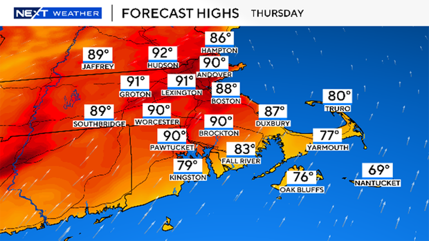
After a bit of unsettled spring, New England is finally flipping the switch. Temperatures will soar into the upper 80s and low 90s Thursday afternoon, and for one of the first times this season, it will feel hot too thanks to rising dewpoints climbing well into the 60s.
That added humidity will make it feel more like the mid-90s at times and set the stage for late-day storms.
Timing and threats
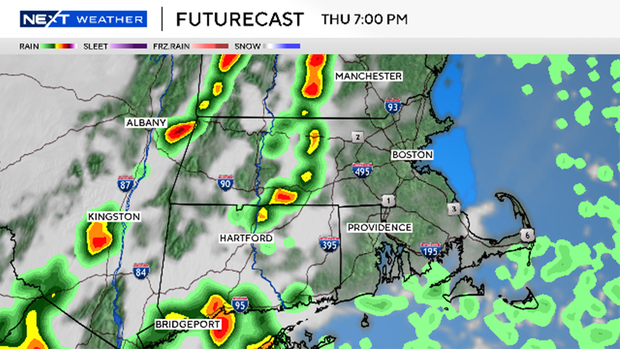
A cold front sweeping through New England Thursday evening will spark scattered storms-most likely between 6 p.m. and 10 p.m.
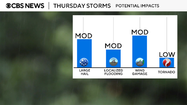
The primary concerns will be:
- Downpours that could lead to brief street flooding
- Gusty winds over 40 mph
- Frequent lightning
- Large hail
Not everyone will see a storm, but those who do could experience a quick burst of intense weather. Stay alert if you have evening plans, especially outdoors.
Looking ahead
The good news? Once this front passes, our summer-like stretch of weather continues. Friday through much of the weekend looks dry, sunny, and seasonably warm.
And yes... it's possible Boston could finally break the infamous rainy Saturday streak we've been stuck in for weeks.
Then next week, the heat turns up even more. We're forecasting highs in the low to mid 90s for several straight days, with a midsummer feel settling in through much of the Northeast.
We'll be tracking the storms closely all day on Thursday. Download the CBS News Boston app, stream live radar on our website, and tune into WBZ for updates from the Next Weather team.


