Scattered storms are rumbling across Maryland Friday evening

Scattered showers and storms continue to roam across Maryland this evening. The stretch of unsettled weather that kicked-off Friday will linger through the weekend and into next week.
Stormy weather may impact Friday plans
Showers and storms will be scattered to numerous through 12 a.m. A couple of storms could become strong, producing gusty winds and small hail. A severe storm, or two, cannot be ruled out; especially before 9 p.m. The greatest chance of seeing severe weather is southwest of the greater Baltimore area.
Even if a storm is not severe, it'll produce heavy rain and frequent lightning.
A Flood Watch is in effect for the D.C. Metro area, parts of Virginia and far southern Maryland.
Wet weather on Father's Day Weekend
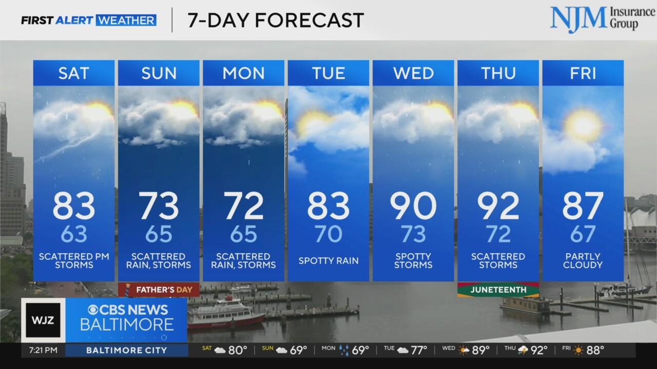
Parts of Maryland will have a damp and stormy night. Rain diminishes early Saturday morning.
Many will wake up to temperatures in the mid to upper 60s early Saturday. Areas of fog and spotty showers are possible through sunrise. Scattered showers and storms will redevelop as temperatures approach 80° Saturday afternoon. The stormiest weather is expected to occur closer to D.C. and across far southern Maryland into Virginia. A couple of storms could produce gusty winds and small hail.
The CBS News App is a free and easy way to be alerted to storms approaching your plans.
Remember, "when thunder roars, move indoors."
More scattered showers are possible on Father's Day. However, Sunday is shaping up to be a bit drier day than Saturday. There will be a dry time to get plans in. Temperatures remain much cooler - stuck in the 70s - Sunday afternoon.
Hotter weather returns to Maryland next week
The next workweek will begin with cooler weather.
Monday afternoon features temperatures in the 70s, with more showers and storms around. More rain and storms may bubble up through the middle of the workweek as warmer weather returns.
Afternoon temperatures are forecast to approach 90° by the end of next week.


