Strong storms with heavy rain, lightning strikes and powerful wind moves through Maryland


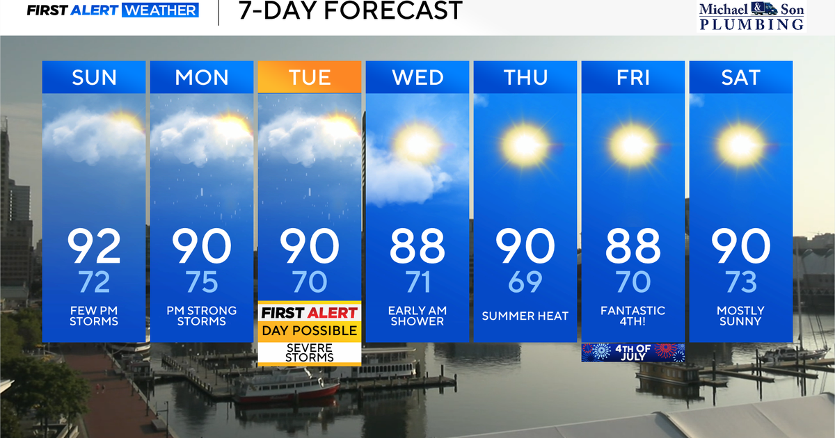
Tuesday is an Alert Day as severe weather is expected in Maryland.
A few light showers were reported Tuesday morning. Storms are expected to move through parts of the state into the evening.
A Flash Flood Warning has been issued for parts of Anne Arundel and Baltimore counties, and Baltimore City.
Severe weather Tuesday in Maryland
Similar to Monday, the greatest concern today will be strong winds.
Maryland has a level 2 out of 5 risk for severe weather in the afternoon, compared to level 1 on Monday.
As a cold front moves eastward, storms will develop. Any storms could produce lightning.
The approaching front, along with high humidity, will help to increase the risk for stronger storms in the Baltimore area.
High levels of moisture in the atmosphere will also increase the flash flood risk today.
A Flood Watch will be in effect from 2 p.m. to 11 p.m. Tuesday. There's the potential for over 3" of rainfall.
Quiet midweek weather
Once the heaviest and strongest storms move out, a few showers will remain overnight into Wednesday.
Thursday will bring a low chance of showers. Overall, the weather will be much quieter once the midweek rain moves out.
Fourth of July weekend forecast
The Fourth of July weekend is looking great.
We'll have typical early July heat and humidity with highs in the upper 80s to around 90°.
Sunshine will dominate the sky over Maryland through the day on Friday. The holiday weekend is looking nice with a mainly dry forecast for both Saturday and Sunday.